hydroguy2
Well Known Member
Been working 6 days a week lately and more to come. But wednesday I had time available for catch up. I'm no Vlad...or any of you lucky ones traveling around the country but I try to put the RV to good use. SO:
My tour as President of the HomeOwner Association came to a close recently. The new President wanted to discuss duties and responsibilities. I live 4.5hrs away(by car) so she suggested a 10am phone call to save me travel.
I woke up and the weather looked good so I called and said "I'll be there by 0930. Climbing out I wondered what I had done the visibility was about 8miles of smoke in the valley. Once I got above 9000' I was on top and other than a 25-30kt headwind viz was better and smooth. Guess that's why I call my RV "Aurora" after the Roman Goddess of the Dawn, I love morning flights.
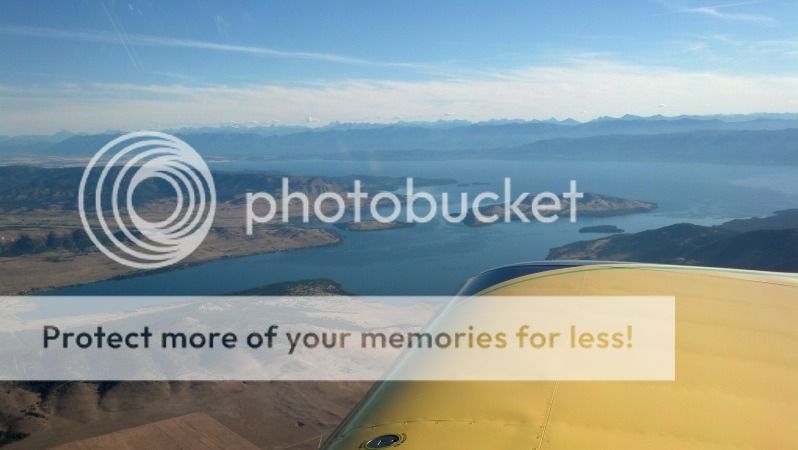
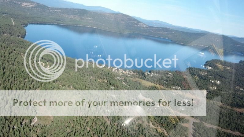
It cleared up as I got north. Wild Horse Island on Flathead lake
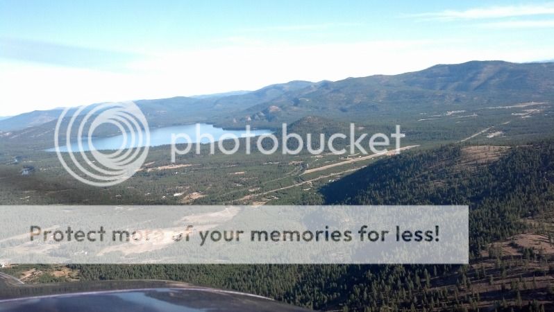
Descending through 6000, Cabin Creek Landing(97MT) is at my 2 o'clock as I approach over the hills from the south. Bitteroot lake was like glass.
Left downwind for RY20. (one lot in foreclosure, will go cheap we think)
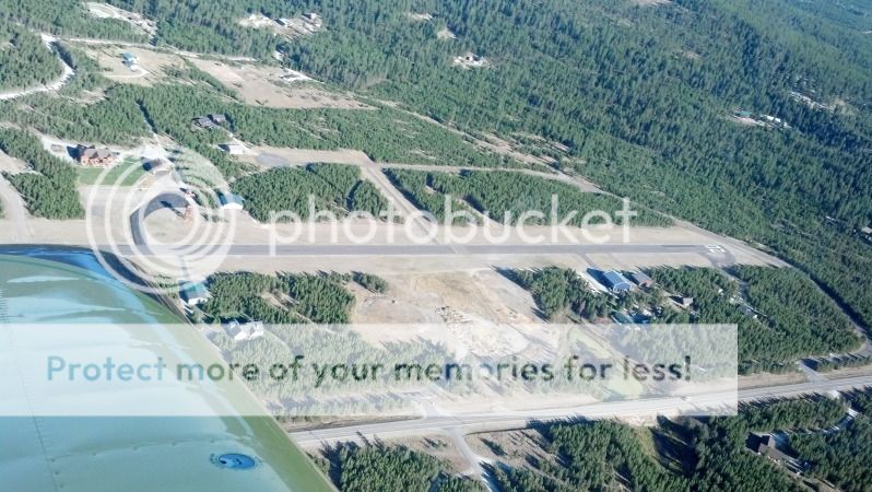
Had some Altitude to burn so I made a crosswind then out over the lake before coming around to land on RY02.
Meeting got over around 1100, so I grab a splash of fuel and saddled up.
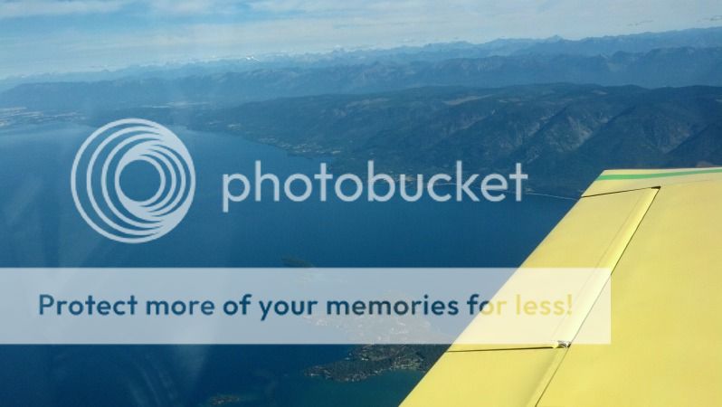
Climbed to 9500 to grab some tailwind, but still bumpy as the mountains heated up...going to 11500. Finley Point under my wing as I crossed Flathead lake was looking inviting. (we've stayed there before).
I went over the Mission Mtns on the return trip. Why does it seem the engine vibrates more when the ground looks like this under me.
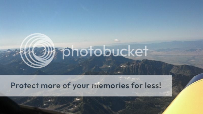
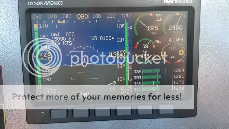
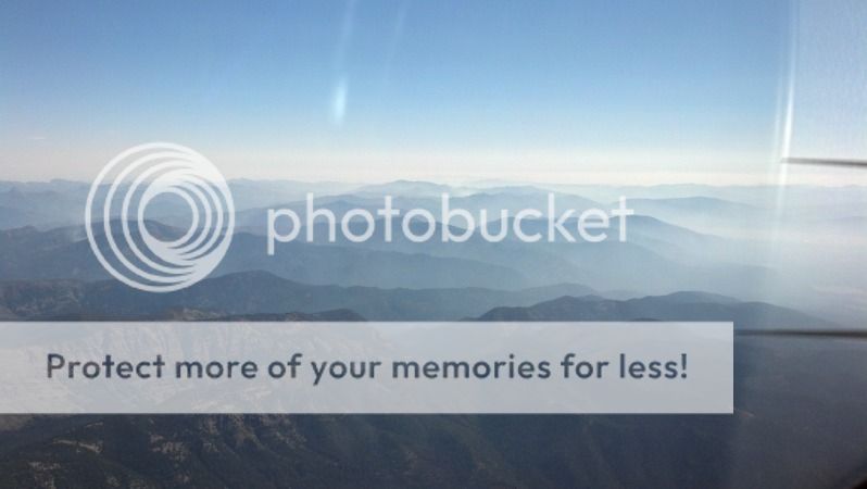
Smoke laying in the valleys of the Bob Marshall Wilderness. shortly after this pic, I ended up climbing to 13500 trying to get out of the smoke.
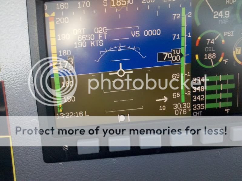
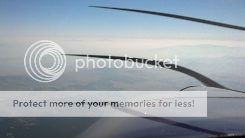
Found a few more Kts of tailwind. I was showing 177kts TAS with a GS of 196-202KTS...on 8.1gph or 28mpg thereabouts.
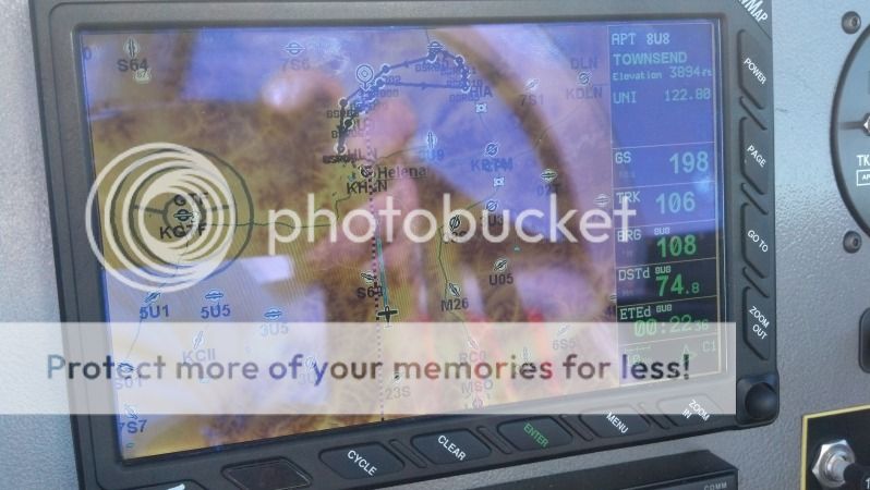
Usually I can see Helena(KHLN) from here <20 miles out...not today.
I stayed high as long as I could but finally had to drop into the haze. this is about 10miles out of Townsend(8U8). The shoreline of Canyon Ferry lake is about 4miles. The smoke just got thicker the lower I went. I finally picked up the airport at 3.5miles.
Meetings suck, but flying to them makes them tolerable. 0.9 hrs home aint' too shabby either. RV's are a great escape even in small bites.....ok back to work, everybody
My tour as President of the HomeOwner Association came to a close recently. The new President wanted to discuss duties and responsibilities. I live 4.5hrs away(by car) so she suggested a 10am phone call to save me travel.
I woke up and the weather looked good so I called and said "I'll be there by 0930. Climbing out I wondered what I had done the visibility was about 8miles of smoke in the valley. Once I got above 9000' I was on top and other than a 25-30kt headwind viz was better and smooth. Guess that's why I call my RV "Aurora" after the Roman Goddess of the Dawn, I love morning flights.
It cleared up as I got north. Wild Horse Island on Flathead lake
Descending through 6000, Cabin Creek Landing(97MT) is at my 2 o'clock as I approach over the hills from the south. Bitteroot lake was like glass.
Left downwind for RY20. (one lot in foreclosure, will go cheap we think)
Had some Altitude to burn so I made a crosswind then out over the lake before coming around to land on RY02.
Meeting got over around 1100, so I grab a splash of fuel and saddled up.
Climbed to 9500 to grab some tailwind, but still bumpy as the mountains heated up...going to 11500. Finley Point under my wing as I crossed Flathead lake was looking inviting. (we've stayed there before).
I went over the Mission Mtns on the return trip. Why does it seem the engine vibrates more when the ground looks like this under me.
Smoke laying in the valleys of the Bob Marshall Wilderness. shortly after this pic, I ended up climbing to 13500 trying to get out of the smoke.
Found a few more Kts of tailwind. I was showing 177kts TAS with a GS of 196-202KTS...on 8.1gph or 28mpg thereabouts.
Usually I can see Helena(KHLN) from here <20 miles out...not today.
I stayed high as long as I could but finally had to drop into the haze. this is about 10miles out of Townsend(8U8). The shoreline of Canyon Ferry lake is about 4miles. The smoke just got thicker the lower I went. I finally picked up the airport at 3.5miles.
Meetings suck, but flying to them makes them tolerable. 0.9 hrs home aint' too shabby either. RV's are a great escape even in small bites.....ok back to work, everybody
")