

N402RH
Well Known Member
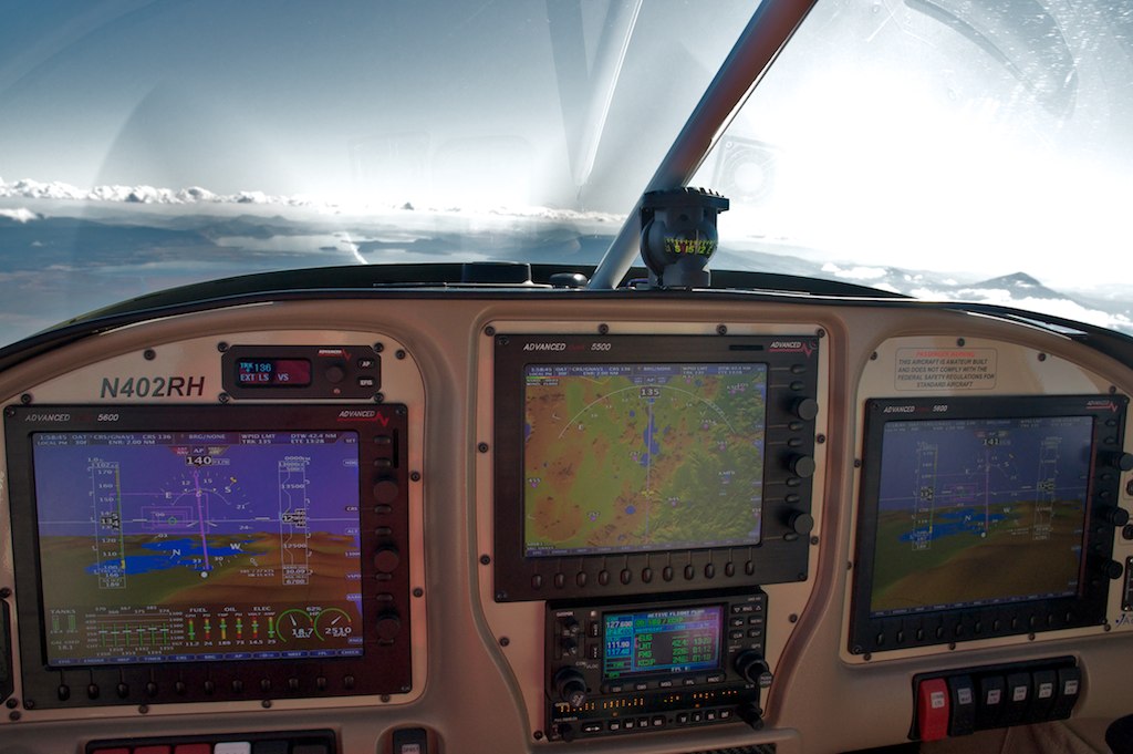
This was my first long trip with the new AF-5000 panel in the RV-10. When I was finally ready to leave for Copperstate on Wednesday there were low clouds and it was raining in Oregon. I ended up departing IFR in the rain and as soon as I reached 6000ft I was back in the sun and headed for Arizona. The new panel worked great, the simplified user interface and large high-resolution screens are awesome. As I passed Las Vegas the sun was setting and I decided to continue on to Casa Grande. It gets really dark, really fast in Northern Arizona when the sun goes down. I was really glad I had synthetic vision, ADS-B traffic, and the new HITS boxes for the airport runways. I managed to work my way into the dark and busy (three other planes) KCGZ traffic pattern using the traffic display on the SV screen and had a perfect landing. I left Canby at 1 PM and touched down in Casa Grande at 6:50 PM with only one fuel stop. That has to be faster than the airlines.
Over Southern Oregon
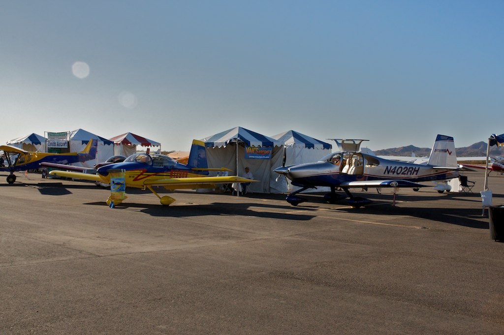
Van's Booth at Copperstate
New Aerosport Products RV-10 Panel
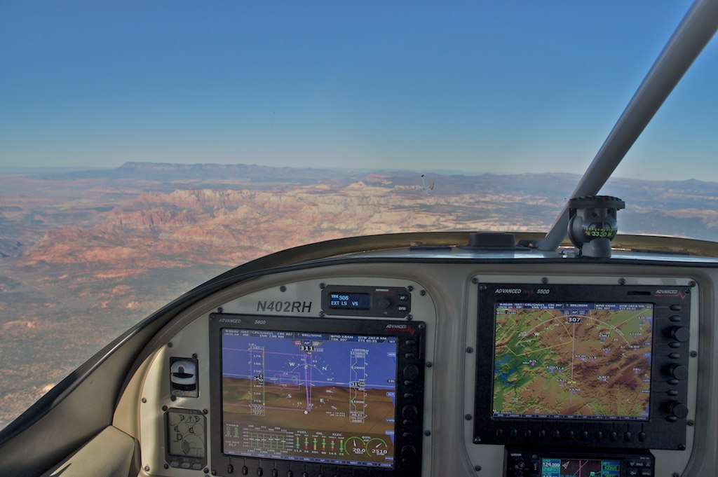
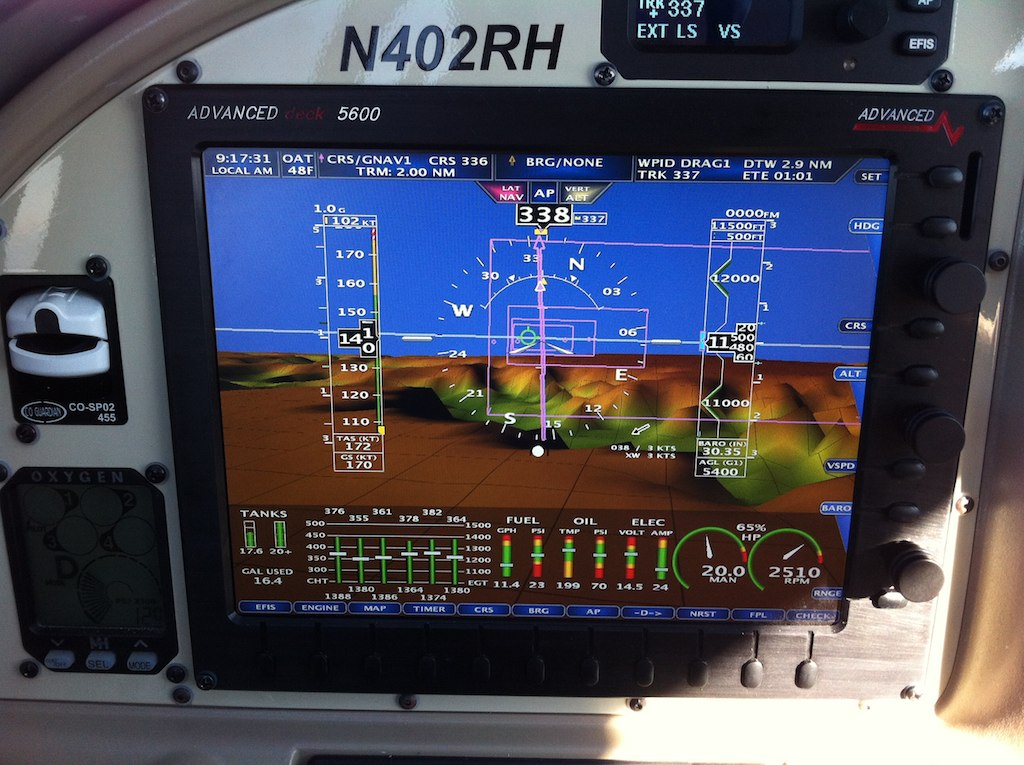
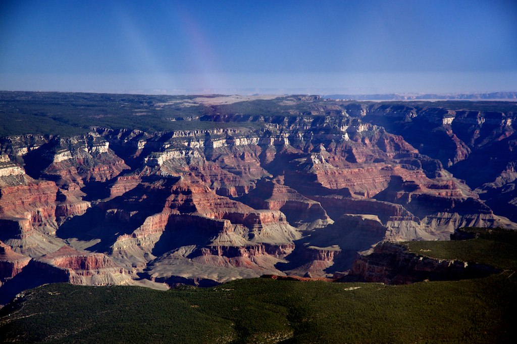
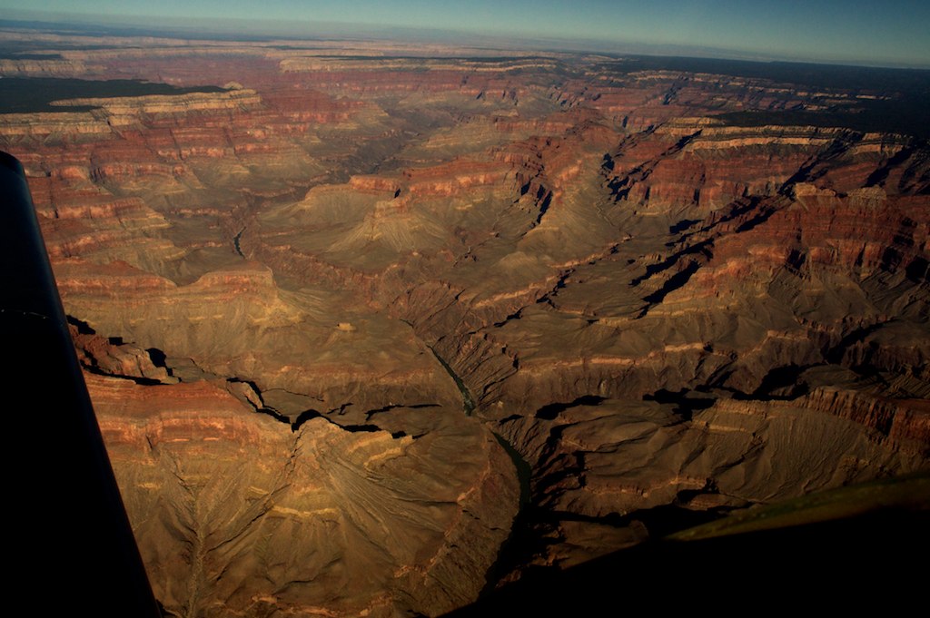
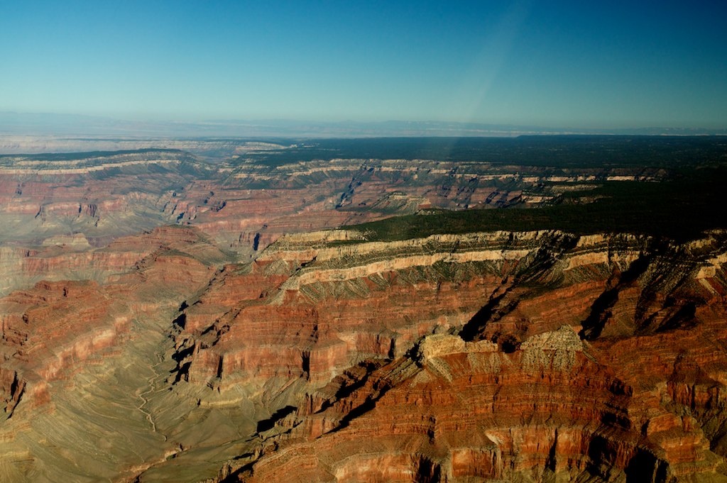
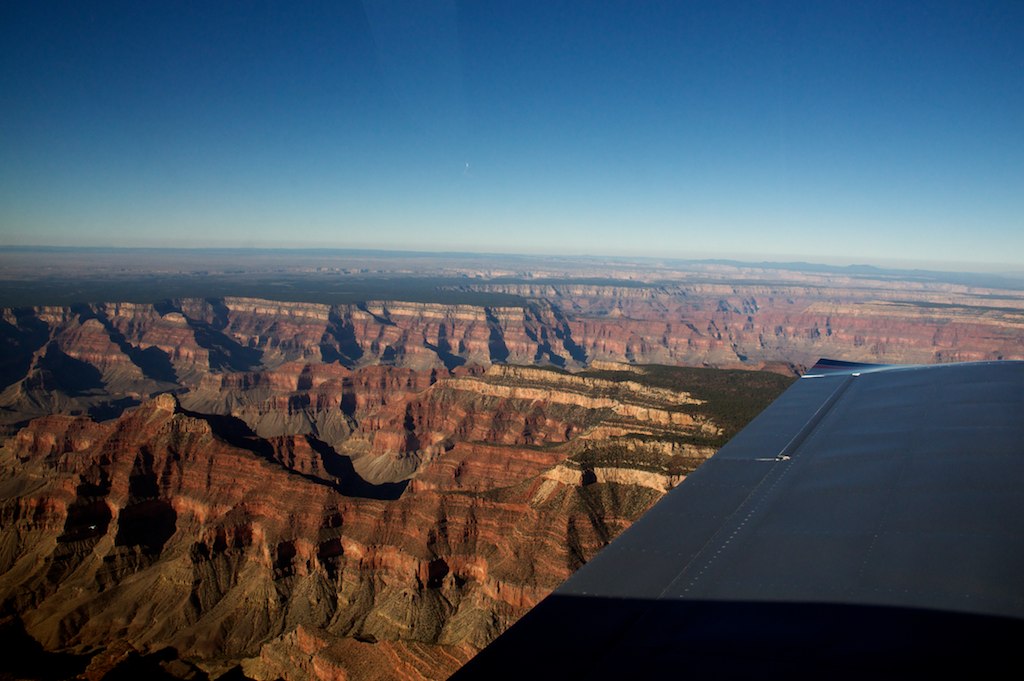
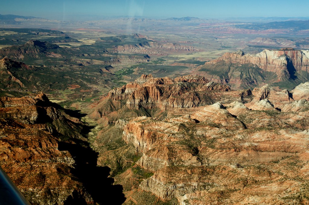
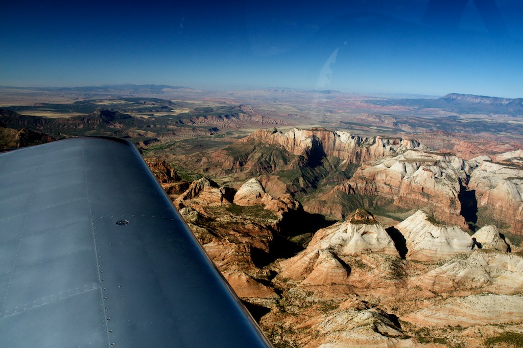
For the trip home, Sterling (in Van's RV-9) and I decided we needed to fly over the Grand Canyon. We purchased the chart for the Grand Canyon at the show and after reviewing the somewhat complicated airspace we decided to fly North and cross the canyon rim in the Dragon Corridor using the minimum northbound crossing altitude of 11,500 feet. The chart gives you the two end point coordinates for the Dragon Corridor. I programmed the route into the GPS so that the AP would fly the required route and I could take pictures (while looking for traffic).
Flying out of Phoenix
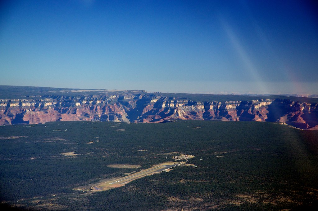
Grand Canyon Airport
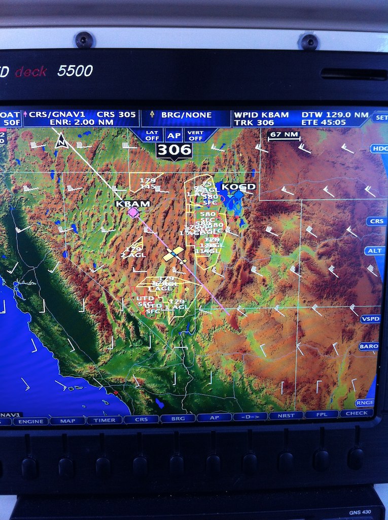
Approaching the Grand Canyon on the EFIS

.... to be continued
Over Southern Oregon
Van's Booth at Copperstate
New Aerosport Products RV-10 Panel
For the trip home, Sterling (in Van's RV-9) and I decided we needed to fly over the Grand Canyon. We purchased the chart for the Grand Canyon at the show and after reviewing the somewhat complicated airspace we decided to fly North and cross the canyon rim in the Dragon Corridor using the minimum northbound crossing altitude of 11,500 feet. The chart gives you the two end point coordinates for the Dragon Corridor. I programmed the route into the GPS so that the AP would fly the required route and I could take pictures (while looking for traffic).
Flying out of Phoenix
Grand Canyon Airport
Approaching the Grand Canyon on the EFIS
.... to be continued
Last edited:
")

