

Van's Air Force

The definitive Van's Aircraft support community! Buying, building or flying an RV? Join our exclusive family of mentors and enthusiasts!

Best Tools and Apps for RV Flight Planning and Weather Briefings?

HarperP_Art

I'm New Here
What are the most useful tools or apps you use for flight planning and weather briefings before flying your RV?
As a relatively new RV pilot, I'm trying to streamline my pre-flight routine and make sure I'm covering all the essentials—especially when it comes to weather and route planning. I'm curious what tools, apps, or websites the experienced folks here rely on before taking off. Any recommendations would be much appreciated!
 
I’ve been using ForeFlight now for quite a few years on my iPad - charts always up-to-date (even if the EFIS database isn;t),western is at my fingertips, traffic available, and flight planning is as good as the data you put in for your airplane.

For many years I used Weathermiester very day to keep up on the atmosphere. Still use it occasionally to check on best cruise altitudes, but have sort of transitioned to ForeFlight for most things.
 
Yeh, Foreflight. I subscribe to Foreflight Pro Plus at $250/year. You'll need an iPad. For weather, I use both WeatherSpork and AWC (https://aviationweather.gov/), as well as the weather functions in Foreflight, which themselves are pretty robust.
 
WingX on an iPad mini. I actually have a slight preference for Foreflight for pre-flight briefing, but WingX for in flight use. All the vfr and ifr charts, approach plates, etc, as well as displaying adsb traffic from a SkyRadar D2 receiver (wifi connection), wx including moving map display, etc. Bonus: advanced version is free for veterans.
Edit: I see you’re from Spain. I cannot comment on European use.
 
If you don’t want to spend the money on Foreflight, give FltPlan Go a try. I used it for all my planning and filing when I flew corporate and still use it in the RV. For the price it is really a great tool. You can plan, file, get wx, download govt. charts, etc. Foreflight is probably better but free is also nice. For work I use Jepp FDpro and WSI, they are great but probably pricey. As a newer pilot and frankly for any pilot, 1-800-WXBRIEF is such a great resource. It’s like having a dispatcher to help confirm assumptions or look at routing and wx through a different lense, and it’s probably the easiest way not to bust a TFR or miss important NOTAMS.
 
Windy
aviationweather.gov (the new interface is nice)
Garmin Pilot
foreflight if flying to unfamiliar airports (community notes)
 
WingX on an iPad mini. I actually have a slight preference for Foreflight for pre-flight briefing, but WingX for in flight use. All the vfr and ifr charts, approach plates, etc, as well as displaying adsb traffic from a SkyRadar D2 receiver (wifi connection), wx including moving map display, etc. Bonus: advanced version is free for veterans.
Edit: I see you’re from Spain. I cannot comment on European use.
That’s cool that WingX is free for Vets, I’ll check it out! Navigating is so much easier these days then using an EA-6B and dead reckoning 😁
 
What are the most useful tools or apps you use for flight planning and weather briefings before flying your RV?
As a relatively new RV pilot, I'm trying to streamline my pre-flight routine and make sure I'm covering all the essentials—especially when it comes to weather and route planning. I'm curious what tools, apps, or websites the experienced folks here rely on before taking off. Any recommendations would be much appreciated!
Hi ,
If I understand correctly you live in Spain ( Europe )
For flying in the EU I can recommend Skydemon . I use it for many years to my complete satisfaction .
Cheers
Wilfried
 
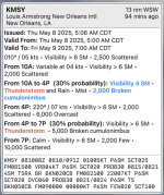
NavMonster (my site) offers a quick glance at the weather (Metars / Tafs / and a bit more). It doesn't replace any of the heavy weight planning tools, but could be the quickest way to get a glance of your route or current location. Web page and iOS app, both FREE.

1746704632545.png
 
I didn't notice that the OP was from Spain. According to a close pilot-friend in Netherlands, Skydemon is an excellent and cost-effective tool that is ideally suited for VFR in Europe, not that great if planning/flying IFR, and he says it's about half the cost of Foreflight.
 
Yesterday we had complicated weather from Nebraska to Eastern Colorado down the front range. No one tool had everything I wanted. I used the NOAA aviation pages to check icing at 9000 over the course of the day. Garmin Pilot had a current image of the weather radar, and good for filing my plan and amending it as the day went on. Skyvector is my fav for looking across the region and looking at METAR/TAF - big picture is super easy.

Yesterday (5/7/25) on the day I really needed the FIS-B uplink in the plane the FAA wasn't providing METAR or Wx Radar. First time in many years I've had that happen. The link was good and data uplink active with 0 time delay. Was getting traffic. But the FAA wasn't sending the METAR or Wx. They were sending old TAF though. But visibility was good and I was low enough to see the radar on the Garmin Pilot (8000 to stay under clouds and avoid icing, but in CO that is often cell phone altitude). Center helped me a bit too.
 
What are the most useful tools or apps you use for flight planning and weather briefings before flying your RV?
As a relatively new RV pilot, I'm trying to streamline my pre-flight routine and make sure I'm covering all the essentials—especially when it comes to weather and route planning. I'm curious what tools, apps, or websites the experienced folks here rely on before taking off. Any recommendations would be much appreciated!
Windy
ForeFlight
 
I use Foreflight. Pretty easy to move around in, and their customer service is absolutely stellar (at least in my opinion). Here's hoping that doesn't change!
 
For those of you using Windy, which forecast model do you prefer? I tend to set up Meteorg. with ECMWF, to show the cloud bases.
 
Have you tried the new Garmin Pilot Web? It's free to all Garmin Pilot subscribers. It has a slightly different interface than the tablet/phone product but is just as powerful.
 
Back
Top