Hey everyone. I'm going to split this into five parts, because... basically because I like to write a lot, and this is just for fun, so I'm not going to worry about editing it down. Feel more than free to just scroll down and enjoy the pictures ") (Then again, if this is a little bit too long... then that's part of the point. This flight was definitely a test of my endurance!)
(Then again, if this is a little bit too long... then that's part of the point. This flight was definitely a test of my endurance!)
Let me start by mentioning my PREVIOUS longest flight: A couple months after I earned my Private Pilot certificate, I flew a 172 from Paine Field (my "home" airfield; I live and work right by it) to Priest Lake and back. It's about 270 miles each way, a cross-country that requires careful planning by a new pilot.... and also a lot of patience: In a Cessna facing 30-knot headwinds, the return trip took almost 4 hours (including a fuel stop). Several months after that, a friend of mine and I bought an RV-6A. I have used it to fly to Priest Lake a few times. That flight got pretty easy, less than two hours each way. So I was looking for the next challenge to continue to increase my cross-country skills. Also, I hope to fly to Oshkosh someday, so I should work my way up to that gradually.
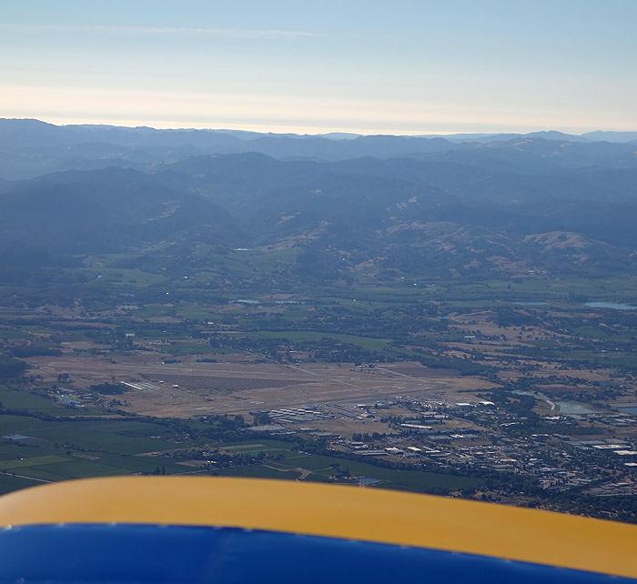
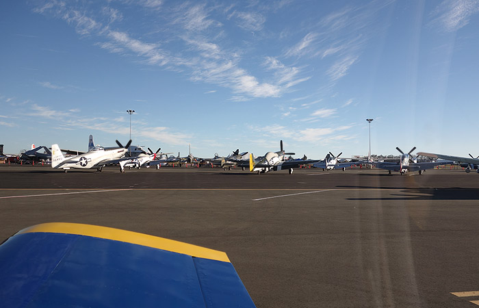
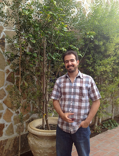
What I finally decided to do: Fly to the Sonoma airshow, "Wings Over Wine Country", organized every August by the Pacific Coast Air Museum. I visited this airshow every year when I lived in California (i.e. 8 times), got to know the organizers, they used my airshow pictures for their promotional materials, and in exchange they got me really cool rides in the airshow airplanes (DC-3, C-17, Harmon Rocket, even the Patriots' L-39s). So now that I was a pilot, I thought it would be cool to fly down there, maybe even give THEM an aerobatic ride in MY airplane!
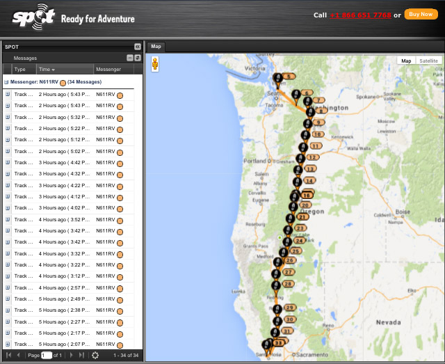
So I planned the trip, as you can see above. It's about 650 miles. Less than three times the distance to Priest Lake, but long enough to require one or two refueling stops (if I'm going to be very conservative about fuel, which I am) and less than 5 hours of flying. Should be doable. I planned on leaving on Thursday August 15th, spend that night in Palo Alto with some college friends, head to Sonoma on Friday (a quick hop), spend the weekend there at the airshow, and fly back home on Sunday night. The weather around mid-August is the best all year, so while nothing was guaranteed, I looked forward to the trip for months.
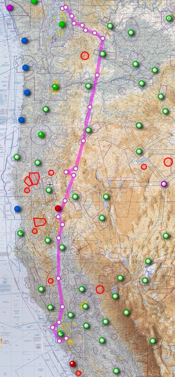
As the date approached, a nasty front was making its way from the Pacific into Washington and Oregon. The weather in most of Oregon was due to be pretty crappy on Thursday, low ceilings all around Portland, a persistent marine layer down the coast... and on top of that, there was a huge number of wild-fires all over the state. For all these reasons, I decided that a good path (as you can see above) would be to cross the Cascades and fly down the eastern side of WA and OR, then fly around Mount Shasta and back over to I-5 once I got to California. The desert-like high plains on the eastern side of the mountains are a lot flatter than the hills and woods on the western side (i.e. in case of engine failure, I could land safely), and the weather is much better (typically sunny, and any incoming front loses most of its steam when it goes east over the mountains into the desert).
So that was the plan. On Thursday, the morning fog took its time burning off, as it does on many days here at Paine Field. And just as it did burn off, that nasty front rolled in from the Pacific. The TAFs had predicted clouds at 4000-5000 feet, plenty high for me to get out of town. But the reality was a ceiling barely 1000 feet AGL, and rain showers. Paine Field was IFR. All day on Thursday I just stayed home, waiting for the weather to let me fly out of here. (At least I got all kinds of random errands and chores done). But no go. I told my friends in Palo Alto that I had to cancel dinner, and that I would be flying straight to Sonoma the next day. They understood. Such is life when you don't have an instrument rating (which is next on my to-do list after I finish paying off the airplane. Probably next year).
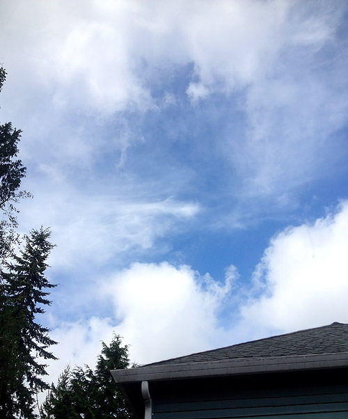
On Friday in the late morning, it was looking like the clouds were finally burning off. The TAFs said the same thing as the day before (ceiling around 4500 AGL, burning off around noon) but this time it looked like it was actually happening. So even though the airport was still IFR, I headed out to the hangar, looking up at the sky (see above) and hoping that the trend would hold.
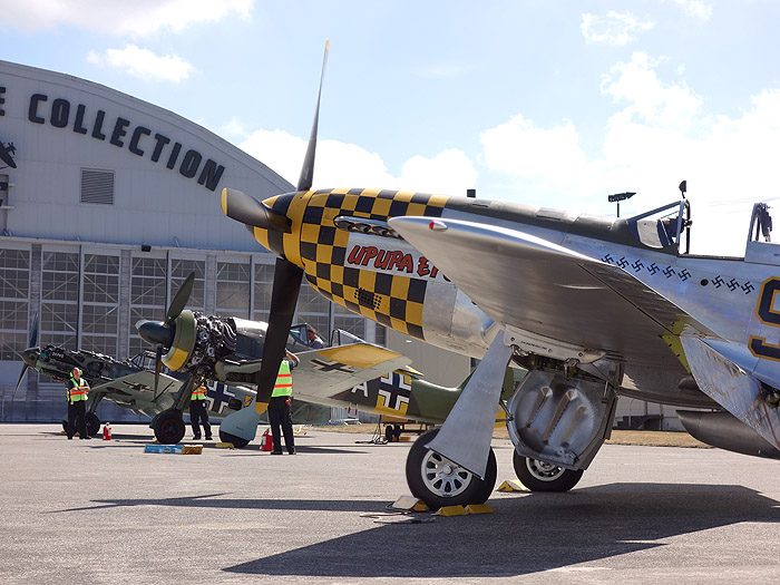
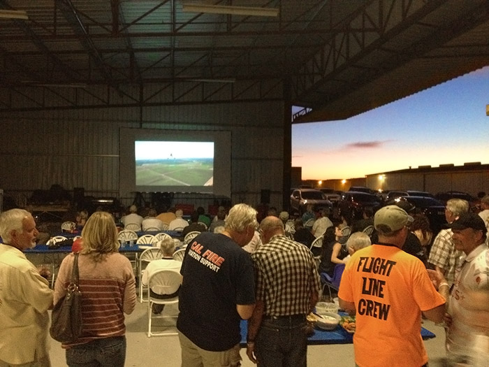
Looks like I'm not the only one who wants to fly today! On the way to my hangar, I pass the Flying Heritage Collection, who was doing engine run-ups on some of their warbirds in preparation for "Luftwaffe Day" flights the following morning.
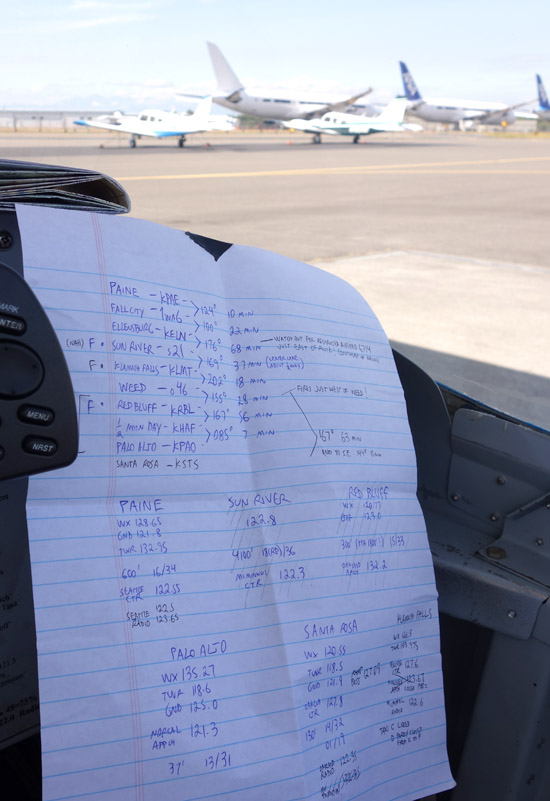
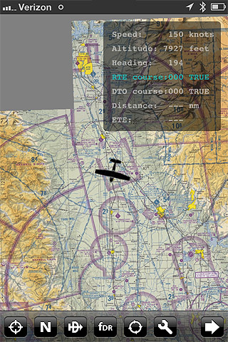
While I was getting fuel, the airport finally went VFR. And best of all, it sounded like there was little to no mountain obscuration over the I-90 pass, which is what I hoped to fly through (or, ideally, over) to go from the Puget Sound area to the high plains of the eastern desert. Here you can see my flight log, with dead-reckoning headings and times between each of the airports along the way, as well as extra info (radio frequencies, runways, elevation, etc) for the airports where I might want to stop for fuel.
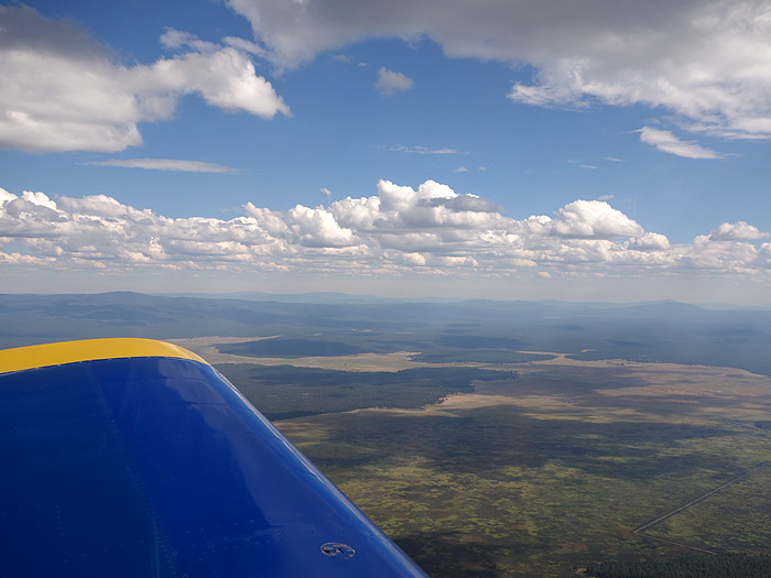
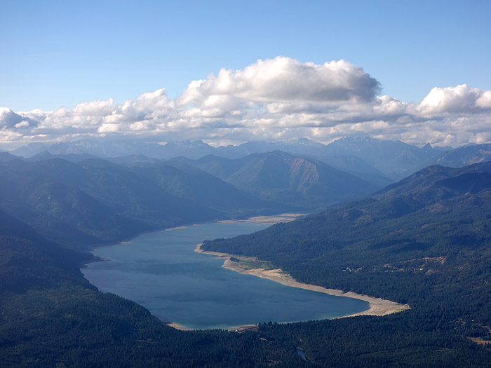
As I climbed out, it was clear that some scattered white puffy clouds would not keep me from crossing the pass. No concerns about mountain obscuration! However, I was aware that this was just the trailing edge of a front that was moving across my intended path. So I was still ready to turn back if I hit a wall of bad weather.
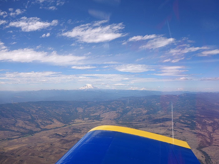
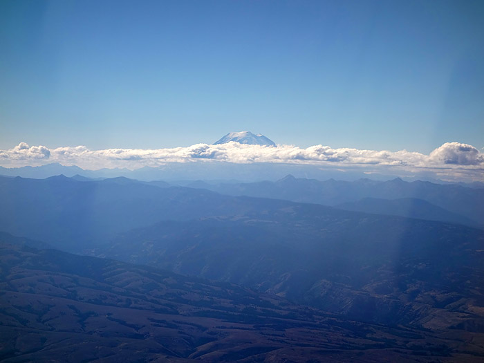
After flying east over the mountains and hanging a right, things looked just fine off my right wing as I looked west, back at Mount Rainier.
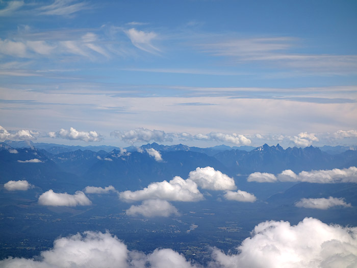
Looking east over my left wing, however, things looked less pretty.
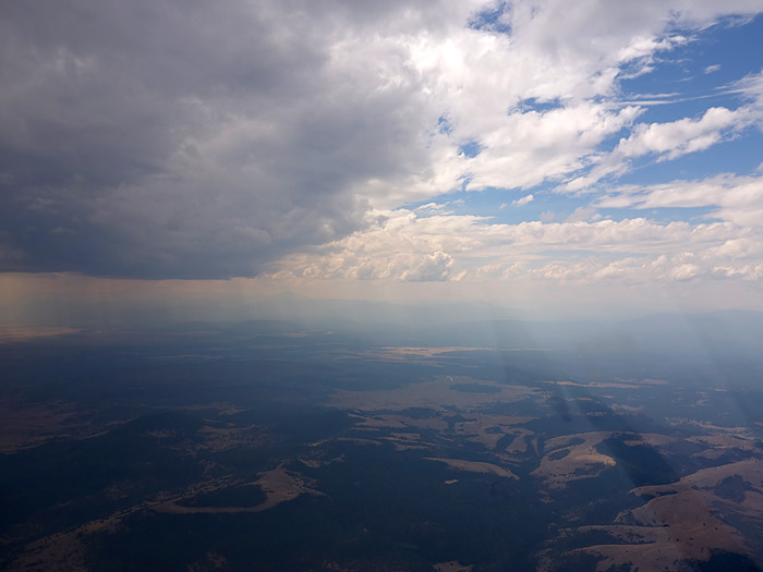
Still, the front seems to have lost a lot of energy when it went over the mountains, so flying under it should not be too huge a problem... right? We'll see.
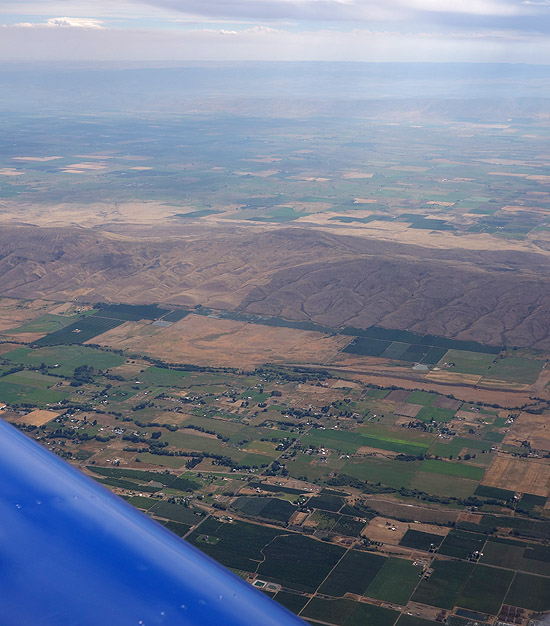
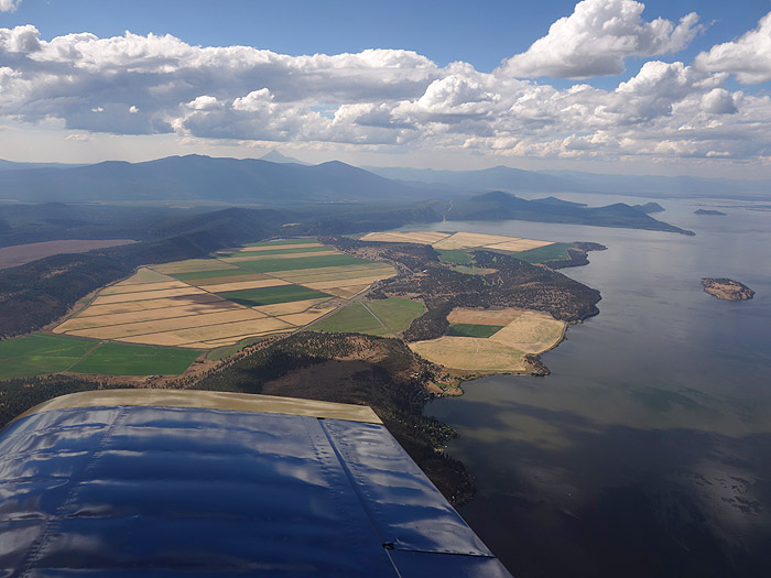
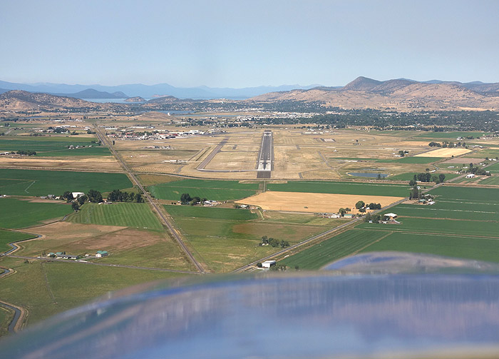
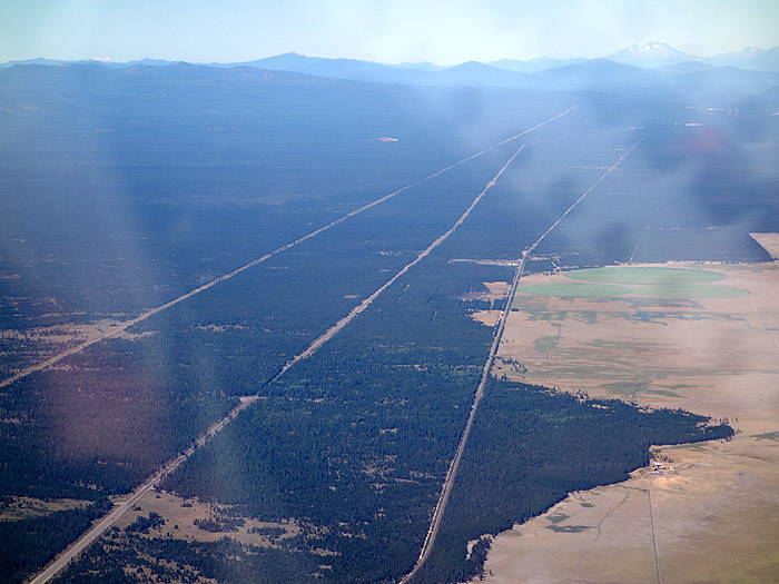
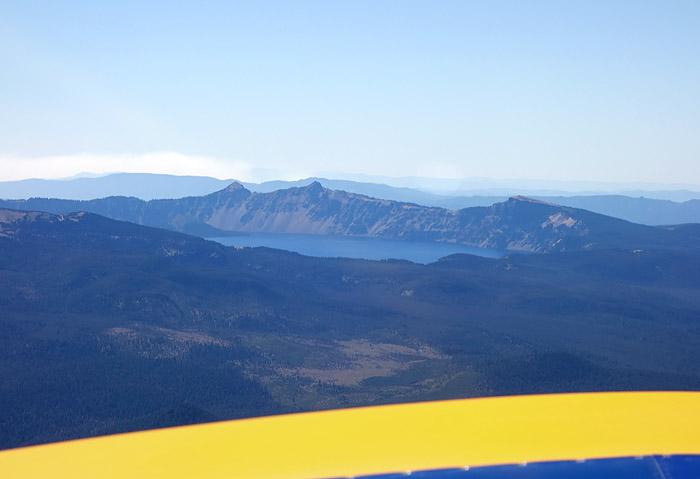
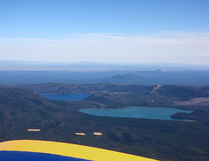
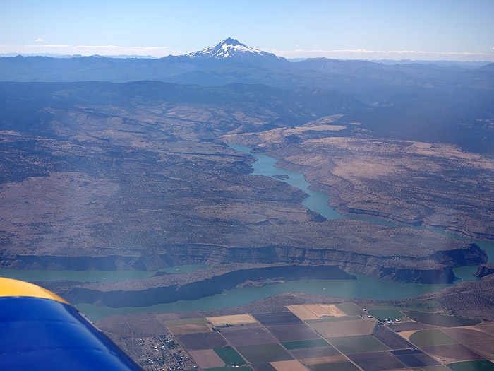
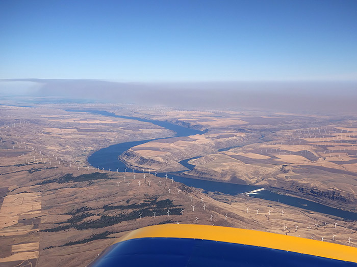
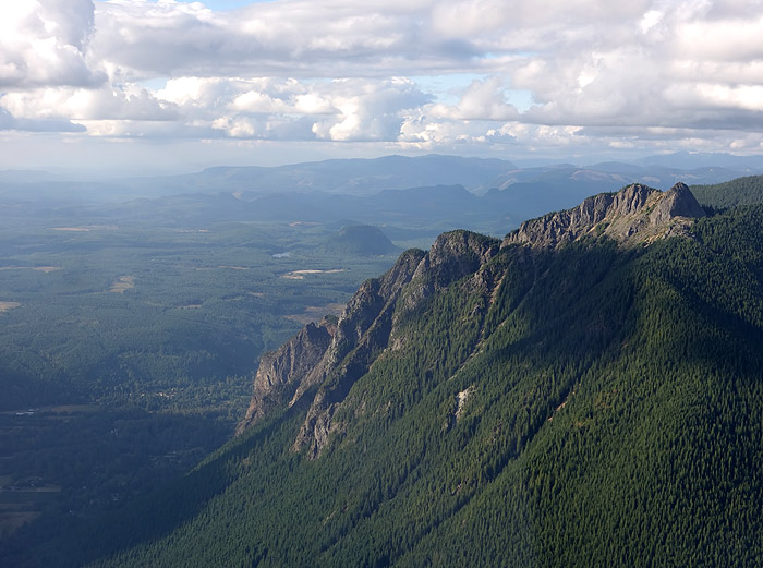
After I crossed the mountains from Seattle to Ellensburg, I basically followed Highway 97 all the way down. (It meets I-5 just west of Mount Shasta, in a pass that looked like the best way to go over that hilly region). I know some people who have spent quite a bit of time in the eastern foothills of the Cascade mountains, and they warned me that the terrain could be quite hilly and full of trees, not ideal for flying over in single-engine airplanes. I was relieved to find that, as long as I followed Highway 97, the terrain was actually very flat and nearly always had clearings and straight roads within gliding distance. I was glad to have picked this route (rather than the I-5 corridor, or the coast).
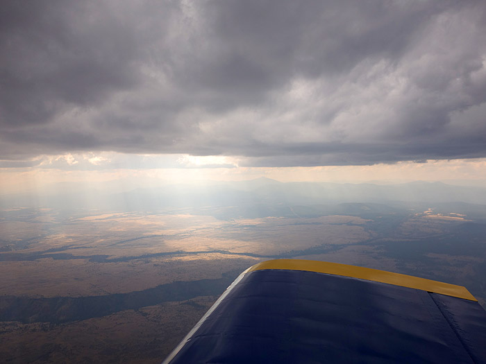
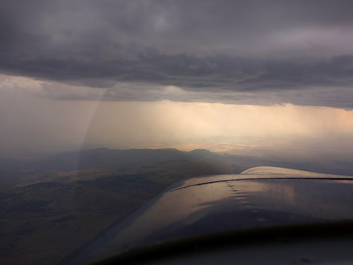
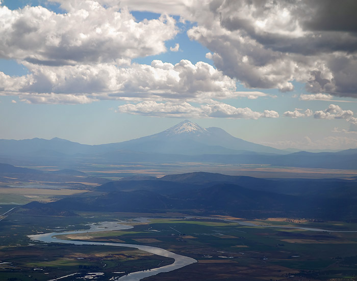
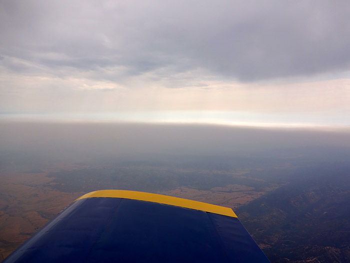
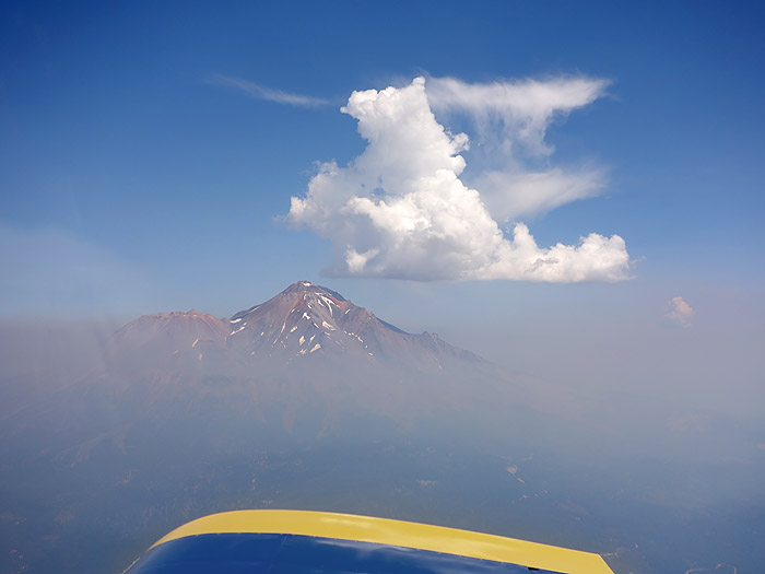
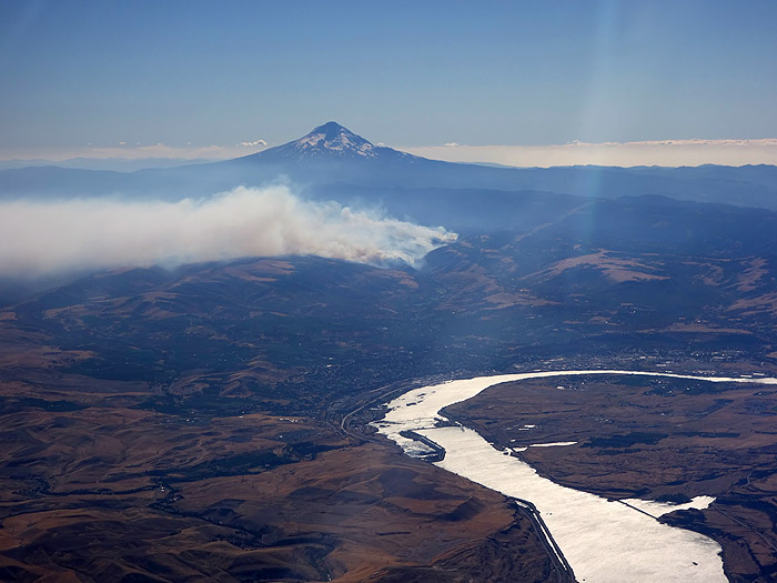
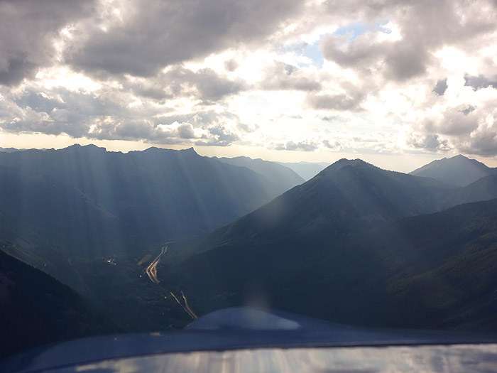
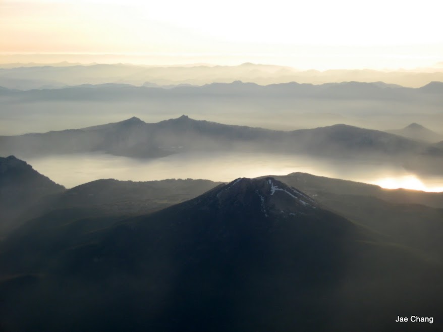
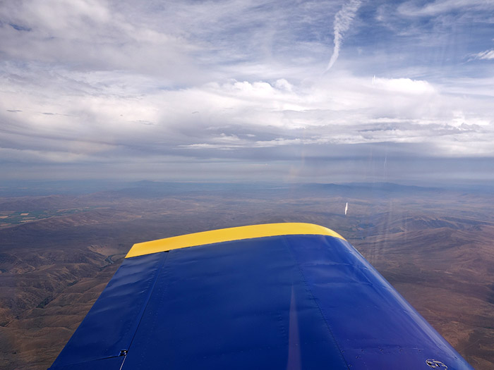
Unfortunately I did have to fly under that front at one point. It may look here like it's raining, but actually what you see in the photo is haze from the wild-fires to the east, with sun beams coming down through holes in the clouds. Here the ground is at about 4000 feet elevation, the clouds are about 4000 to 5000 feet above that, and I'm about 500 feet below them, i.e I'm at 7500 to 8500 feet MSL.
(Then again, if this is a little bit too long... then that's part of the point. This flight was definitely a test of my endurance!)
Let me start by mentioning my PREVIOUS longest flight: A couple months after I earned my Private Pilot certificate, I flew a 172 from Paine Field (my "home" airfield; I live and work right by it) to Priest Lake and back. It's about 270 miles each way, a cross-country that requires careful planning by a new pilot.... and also a lot of patience: In a Cessna facing 30-knot headwinds, the return trip took almost 4 hours (including a fuel stop). Several months after that, a friend of mine and I bought an RV-6A. I have used it to fly to Priest Lake a few times. That flight got pretty easy, less than two hours each way. So I was looking for the next challenge to continue to increase my cross-country skills. Also, I hope to fly to Oshkosh someday, so I should work my way up to that gradually.
What I finally decided to do: Fly to the Sonoma airshow, "Wings Over Wine Country", organized every August by the Pacific Coast Air Museum. I visited this airshow every year when I lived in California (i.e. 8 times), got to know the organizers, they used my airshow pictures for their promotional materials, and in exchange they got me really cool rides in the airshow airplanes (DC-3, C-17, Harmon Rocket, even the Patriots' L-39s). So now that I was a pilot, I thought it would be cool to fly down there, maybe even give THEM an aerobatic ride in MY airplane!
So I planned the trip, as you can see above. It's about 650 miles. Less than three times the distance to Priest Lake, but long enough to require one or two refueling stops (if I'm going to be very conservative about fuel, which I am) and less than 5 hours of flying. Should be doable. I planned on leaving on Thursday August 15th, spend that night in Palo Alto with some college friends, head to Sonoma on Friday (a quick hop), spend the weekend there at the airshow, and fly back home on Sunday night. The weather around mid-August is the best all year, so while nothing was guaranteed, I looked forward to the trip for months.
As the date approached, a nasty front was making its way from the Pacific into Washington and Oregon. The weather in most of Oregon was due to be pretty crappy on Thursday, low ceilings all around Portland, a persistent marine layer down the coast... and on top of that, there was a huge number of wild-fires all over the state. For all these reasons, I decided that a good path (as you can see above) would be to cross the Cascades and fly down the eastern side of WA and OR, then fly around Mount Shasta and back over to I-5 once I got to California. The desert-like high plains on the eastern side of the mountains are a lot flatter than the hills and woods on the western side (i.e. in case of engine failure, I could land safely), and the weather is much better (typically sunny, and any incoming front loses most of its steam when it goes east over the mountains into the desert).
So that was the plan. On Thursday, the morning fog took its time burning off, as it does on many days here at Paine Field. And just as it did burn off, that nasty front rolled in from the Pacific. The TAFs had predicted clouds at 4000-5000 feet, plenty high for me to get out of town. But the reality was a ceiling barely 1000 feet AGL, and rain showers. Paine Field was IFR. All day on Thursday I just stayed home, waiting for the weather to let me fly out of here. (At least I got all kinds of random errands and chores done). But no go. I told my friends in Palo Alto that I had to cancel dinner, and that I would be flying straight to Sonoma the next day. They understood. Such is life when you don't have an instrument rating (which is next on my to-do list after I finish paying off the airplane. Probably next year).
On Friday in the late morning, it was looking like the clouds were finally burning off. The TAFs said the same thing as the day before (ceiling around 4500 AGL, burning off around noon) but this time it looked like it was actually happening. So even though the airport was still IFR, I headed out to the hangar, looking up at the sky (see above) and hoping that the trend would hold.
Looks like I'm not the only one who wants to fly today! On the way to my hangar, I pass the Flying Heritage Collection, who was doing engine run-ups on some of their warbirds in preparation for "Luftwaffe Day" flights the following morning.
While I was getting fuel, the airport finally went VFR. And best of all, it sounded like there was little to no mountain obscuration over the I-90 pass, which is what I hoped to fly through (or, ideally, over) to go from the Puget Sound area to the high plains of the eastern desert. Here you can see my flight log, with dead-reckoning headings and times between each of the airports along the way, as well as extra info (radio frequencies, runways, elevation, etc) for the airports where I might want to stop for fuel.
As I climbed out, it was clear that some scattered white puffy clouds would not keep me from crossing the pass. No concerns about mountain obscuration! However, I was aware that this was just the trailing edge of a front that was moving across my intended path. So I was still ready to turn back if I hit a wall of bad weather.
After flying east over the mountains and hanging a right, things looked just fine off my right wing as I looked west, back at Mount Rainier.
Looking east over my left wing, however, things looked less pretty.
Still, the front seems to have lost a lot of energy when it went over the mountains, so flying under it should not be too huge a problem... right? We'll see.
After I crossed the mountains from Seattle to Ellensburg, I basically followed Highway 97 all the way down. (It meets I-5 just west of Mount Shasta, in a pass that looked like the best way to go over that hilly region). I know some people who have spent quite a bit of time in the eastern foothills of the Cascade mountains, and they warned me that the terrain could be quite hilly and full of trees, not ideal for flying over in single-engine airplanes. I was relieved to find that, as long as I followed Highway 97, the terrain was actually very flat and nearly always had clearings and straight roads within gliding distance. I was glad to have picked this route (rather than the I-5 corridor, or the coast).
Unfortunately I did have to fly under that front at one point. It may look here like it's raining, but actually what you see in the photo is haze from the wild-fires to the east, with sun beams coming down through holes in the clouds. Here the ground is at about 4000 feet elevation, the clouds are about 4000 to 5000 feet above that, and I'm about 500 feet below them, i.e I'm at 7500 to 8500 feet MSL.
Last edited: