What's new
Van's Air Force

Don't miss anything! Register now for full access to the definitive RV support community.

Bendix King AV8OR handheld GPS

Hi Andy,


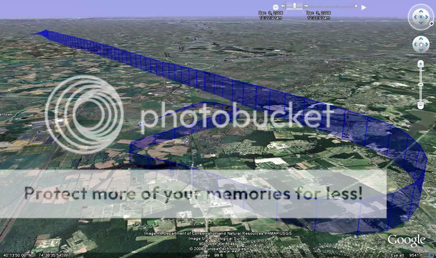
The Google Earth flight log is in XML format and doesnt display so well unless you have an XML editor.

I've been using the Google Earth ones. I wonder if it is as simple as trying to find a free XML editor on the web someplace. Like you said, it's very difficult to make sense of it in Notepad or something similar because it just creates one long string of data.

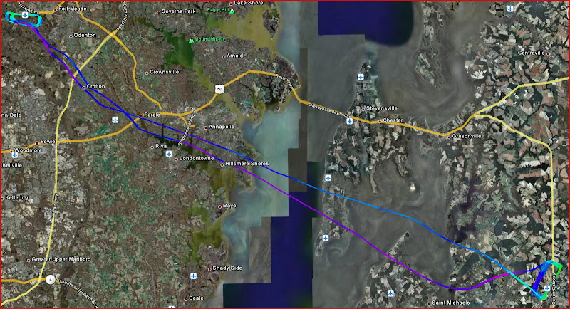
What are you doing with the Bendix log? That is, Google Earth makes the Google flight log meaningful (fun to look at). How would you do something similar with the Bendix log? I guess there must be some sort of application I don't have!?

I've been wanting to get night current for a while now, but the cold weather at home has taken some of the wind out of my sail. It's bad enough preflighting in the morning, so I might not get to test the AV8OR at night for a while!!

Thanks!
 
Looks like Microsoft has a free download for XML Notepad 2007. I'll have to give that a look when I get back to my own computer.
 
Screen Brightness

I just flew with mine for the first time. The problem I had was that after a few seconds the screen dimmed to a point that I could not see it. It was a sunny day but it dimmed itself to much. Anyway to overcome this.

Pat Stewart
N184PS
 
I just flew with mine for the first time. The problem I had was that after a few seconds the screen dimmed to a point that I could not see it. It was a sunny day but it dimmed itself to much. Anyway to overcome this.

Pat Stewart
N184PS


I know what you mean, and I am not in range of my manual, but there is a setting for it I am sure. I have never had mine autodim in the plane during the day, and have never had a problem seeing the screen in a skyhawk anyway. I think there may be two places to change the backlight (a guess from memory). One is in the setting area before you choose Go Fly or Go Drive (or anythign else). Then, I think there might be a second setting in the Go Fly set-up someplace. I am sure one of those has an option to "lock" the back light.
 
Wx Price??

My brother in law works for Honeywell and forwarded an offer for employee pricing on the Av8or. I had been planning to buy a 396. The price being offered is $399 plus the coupon for $250 off of WxWorx XM setup. So I go to their website to find out what the weather option will cost. Nearly $1200 for the bluetooth setup? They've got to be kidding!! I expected half that at the most. Am I missing something here?
 
I think you should check with a dealer such as Aircraft Spruce, Chief, Gulf Coast Avionics, etc. I believe the "street price" after the $250 discount should be in the $500-$600 range for the bluetooth XM box. That's what I paid about 6 months ago...
 
Buy the xm receiver directly from WxWorx

If you go to https://www.bendixking.com/AV8OR/AV8OR/default.html
The WxWorx bluetooth receiver is $472.61 or $376 for the serial receiver after discount.

Quote from page "Purchase an AV8OR? and receive a coupon from WxWorx in the box good for the purchase of a WxWorx Bluetooth? receiver for the discounted price of $472.61 (Wireless Bluetooth receiver bundle) or $376.00 (Wired RS232 receiver bundle). Limit one receiver per AV8OR purchase. Receiver must be purchased directly from WxWorx using the enclosed coupon."


This would put your total price for everything at 775 to 871 (plus tax, etc). Not bad for XM weather!


I would suggest the bluetooth option is the way to go so you can reserve your serial port for connection to another serial device, such as an autopilot.
 
Next Software update available on web- Must Have.

I just checked this morning and the latest software revision 0104 is on the net at the AV8OR website.

From the update brochure:

Updates include:

Traffic interface to Zaon,
Graphical PIREPs,
TFR and Lightning overlays
GPS NMEA output - tested on Trio, Dynon and Tru-Trak APs
Multiple flight logs
Man made obstacles show in Smart Profile
New menu page

I have been flying a pre-release verson of this and highly recommend that you upgrade.

Good to hear. I was out there looking yesterday or Saturday and it was still the previous version.

They actually included the Flight Log fix too! I tried editing with XML Notepad, but it was a much bigger project than just identifying the lines in the file that you didn't want. I'm anxious to see what the fix looks like (hopefully Friday!).
 
I updated my firmware and software last night. Very simple to do. Incidentally, I updated my database about a week earlier, before my trip to Myrtle Beach. I used the free one-time update that comes with the unit. All updates were similar and very simple.

One comment for anyone that might be looking at this thread from time to time. The updates reset all your user settings. That is, all the choices you made in GoFly, for things like airspace boundaries and inclusion or exclusion of things like NDBs and VORs, all get reset to factory default. The AV8OR tells you this after you boot the GoFly function the first time with the new updates installed. It was a surprise and kind of annoying to see at first, but it didn't take long to go back and tweak the settings again. I'm not sure I even got them close to the way I had them, but I was certainly more familiar with the unit now, so it didn't take more than about 10 minutes of tinkering.

There is a new set of main menu buttons now because they added the traffic functionality. Other than that, everything seemed about the same. I hope to fly mine on Friday before some weather comes in. If I do, I'll let you know what I think of the new flight logging.

Andy
 
Last edited:
I got to test the AV8OR today with the updated software and firmware. I don't use the weather or traffic, so I can't help you there. The thing I was interested in was the flight logging.

I am disappointed to say that they did tweak the functionality to allow more than one flight log, but they did it incorrectly (in my opinion). That is, they allowed the AV8OR to append multiple flights into one log. For example, I flew from Caldwell to Sullivan County back on 12/3. That flight log was still in my unit. Today, I flew from Caldwell to Flying W in South Jersey, and then flew back with a diversion to Trenton-Robbinsville. I took a look at the log tonight and was surprised to see a single log file. I wondered what it would reflect since I made so many legs today. When I opened it, it had simply appended the day's flights to the last bit of flight log from 12/3.

I don't think this is of much use to anyone, especially since you can't really cut the logs into individual legs (at least I couldn't figure out how to do it). So I will send an email back to the person I spoke with about the logs a while back. They followed though on their promise to patch the program, so I am sure they will be happy to have a conversation regarding this new fix.

At any rate, the AV8OR worked like a champ. I was able to divert to Trenton-Robbinsville using the airport info in the AV8OR. I was on my way back to Caldwell and the airport came up under my right wing. It looked like nobody was using it, so I looped around and logged a landing. What a great day of flying!:)

Andy

FlightLog-1.jpg
 
AV80R and FlightStar

Has anyone managed to load Jeppesen FlightStar routes into the AV80R?

I've copied the generic text format *.txt files into the /user subdirectory as per the manual but all I get is the warning ' 'Failed to read FPL waypoint from file'. THe manual lists this warning with no suggestions about why it should occur. I did manage to add a route by editing the Flightstar output into the fplan.bk file using Notepad but that's not exactly the idea!

Apart from that, my first impressions are that that the AV80R is a great little unit. Just needs a few bugs sorting out. I understand that a fix for the waypoint edit bug is on Beta release. Maybe the FlightStar problem is another one waiting a fix. Any ideas?

Also, this is a great forum for AV80R owners. Thanks for all the feedback and ideas.

Mike
 
Re: AV80R and FlightStar

OK - I got it to work. The 'Failed to read FPL waypoint from file' message occurs when there is already a waypoint in the AV80R with the same name as the FlightStar waypoint you are trying to import. This confusion arises because FlightStar automatically numbers waypoints on a new route as WP 1, WP 2 etc, and AV80R waypoints are similarly numbered. Pre-software update 01/04 you couldn't rename these, but that bug has now been fixed. I think the simplest solution is to rename the FlightStar waypoints before exporting. It is necessary to name the export file 'route.txt' (not case sensitive) Nothing else will work. That just about sorts out all the problems I've found so far.

Mike
 
Hey Mike, glad it worked out. We all seem to be solving our own problems!!

I was just curious why you are using the Jep software. Do you use a lot of user waypoints, and are they easier to create in FlightStar? The reason I am asking is because all my plans have been between 2 airports, or maybe 3 if I put a bend in the route for some airspace reason. Then again, I can't fly far enough on a 2 hour block to really need much more. So so far, I haven't had trouble just punching in a quick flight plan the night before or even on the ramp.

Thanks.
 
Text to Speech?

I've been reading through the info on the B/K site about the Av8or and I am confused as to whether the unit will actually pronounce the street names or not. The marketing info is a bit vague on this and I remember reading earlier in this thread that it does not pronounce street names. Can any one confirm this?
Thanks!
 
It does not. But after using it a few times, there is no need or benefit from that, in my mind. The bottom of the screen shows you which street you are on, and the top of the screen tells you the next street you are going to be on. You can use that with the two icons on the top left that show the next two turns or merges or whatever the unit is going to tell you to do. For example, exit left, or enter the roadway, etc..

It worked out great for me all the way to Myrtle Beach and back (almost 700 miles each way), not to mention all the driving I did while I was there. I used it to find gas, a hotel, a Food Lion supermarket, and my brother's work place.
 
Long time lurker and first time poster here......

I really appreciate all of the posts re: the AV8OR. I just got mine (for x-mas) and your posts have been very helpful. Using this has been VERY intuitive thus far. The driving feature has been great. Work and weather have kept me from flying it yet, but gonna change that this week! I felt much better pulling the trigger on this purchase after reading all your posts and so far am very pleased.

Thanks guys!!
 
I too received an AV8OR for Christmas - here's something I just learned from Bendix/King. Updates to the automotive database are not included in the data updates (the 13 cycle / year updates). An update to the auto database will require a new data card for $149.

It seems like a little forethought on B/K's part would have made everyone's life a little easier. Nav N Go, which provided the Go Drive software for the AV8OR, has a means to update units through their website at http://www.naviextras.com. It seems the AV8OR isn't compatible with their update method, though.

That's a shame, too, because I like the software for driving (still haven't gone flying with it). At least I can keep my old Garmin i3 going for $70/year, and I don't have to worry about anyone stealing it :p

Paul
 
Google Earth /AV8OR

I am disappointed to say that they did tweak the functionality to allow more than one flight log, but they did it incorrectly (in my opinion). That is, they allowed the AV8OR to append multiple flights into one log. For example, I flew from Caldwell to Sullivan County back on 12/3. That flight log was still in my unit. Today, I flew from Caldwell to Flying W in South Jersey, and then flew back with a diversion to Trenton-Robbinsville. I took a look at the log tonight and was surprised to see a single log file. I wondered what it would reflect since I made so many legs today. When I opened it, it had simply appended the day's flights to the last bit of flight log from 12/3.

I don't think this is of much use to anyone, especially since you can't really cut the logs into individual legs (at least I couldn't figure out how to do it). So I will send an email back to the person I spoke with about the logs a while back. They followed though on their promise to patch the program, so I am sure they will be happy to have a conversation regarding this new fix.

Andy

Hi Andy,
I have been playing around with the new flight log format and the google earth format may do what you want it to do. When you click on the kml file, it shows all of the individual legs or trips on google earth. On the Places menu (left side of Google Earth on my display) each individual flight is listed under AV80R Flight Log with the same name "Flight Points". You can select each flight to display or not and also select each point in each flight to display or not. If you want to have an individual log of each file, you can right click on each Flight Points and email it to yourself as an individual kml file. You can also rename each Flight Points into whatever name you want that makes sense to you.
I uploaded a screen shot of my pc that kind of shows this.

google_kml.jpg
 
Last edited:
That's excellent news. Thanks Tom. I was certain that you should be able to do something like his in GE. But I could not for the life of me find it. I even went to the GE site to try to learn more.

Since my last posts, I did play around in XML Notepad some more and found out way to strip out the Sullivan County flight data. But I couldn't do it well enough to break the Flying W day into segments. It was all trial and error. I did stumble across a bunch of programs the let you go from Excel to .KML. That would have been my next attempt at doing the edit. The other two log files in the AV8OR are much simpler to read in notepad because they are .txt. But this was all more of an intellectual exercise. I didn't really want to have to do any of this, or learn how to read/write a .kml file. So I will gladly try what you suggested. I guess at some point, it might even be interesting to create a GE view with ALL of the log files. I guess that would be like pinning a still image with all the places you've landed.


For the other posters, welcome! I'm sure you will like your new AV8ORs too. I never considered updating the streets database, but at $150, it seems cost prohibitive (considering you can get a really decent street GPS for around $200 now I think).
 
Automotive nav data

Hi Paul,

I am hoping that Bendix/King is working on a deal with NavNGo to let users uodate the automotive Nav data from the Bendix/King website.
With all of the new photo radar cameras going up on all the freeways around Phoenix, it would be nice to have updated automotive nav data that pops up an alert when you get close to one.

AV8OR currently verbally lets me know whenever I go over the speed limit.
I am getting tired of hearing the same voice all the time though so I changed it to speak in french instead.

The other thing I would like to see is a RAM mount for AV8OR so I can mount it to the existing RAM ball mount in my RV-4 that I use for the Garmin 496.
 
I had to turn off the speed warning...she (the Australian woman that lives in the GPS) was beginning to nag me.

It should be easy to update the data...after all, it's on an SD card. I like the software, though. I don't think Bendix/King has grasped that they've made a mass consumer product and thus need a website more friendly to the masses.

Paul

I went from Australian woman to British woman recently myself. I may look for some Asian dialect soon! Oh, and I shut the speed warnings too.

I agree on the Honeywell support. I originally felt like there was no way we would get any attention. The product seemed to be a spec on the product list. But to my delight, if you have the patience to find your way into the right people, I've never been turned away disappointed. You just have to endure the phone-link game from one of the 800 numbers listed on the AV8OR section of the site. They seem to be addressing the little (and some bigger) problems we are all talking about though so good for them!

I'd love to seem them add a support forum for the AV8OR - then we'd be able to collect our issues in one place and they'd be able to build customer loyalty.

Paul
 
Tom, you're a genius. Ridiculously simple! I stripped out the leg from Flying W to Trenton-Robbinsville. I think this is going to be a lot of fun now. Oh, I have some phantom date showing up in in GE. You can see it at the time slider in the pic. The date of 12/3 is coming from the prior flight I mentioned in the log file. I'm sure I can tweak that someplace in GE just like you discovered the way to split the flight legs though.

Thanks. Andy

N14-N87.jpg
 
Hooking an AV8OR to an autopilot

Guys, Now King have enabled an output port has anyone hooked up an AV8OR to an autopilot? I'm guessing you would use the USB port, can I get any USB cable, cut the flat end off and wire it into the GPS input on the Autopilot (TT Digiflight II)? Any one know the pin outs?

Thanks, Pete
 
Thanks Andy. Not smart, just playing around on the computer instead of working on my RV 4 and RV-6a projects.
 
Guys, Now King have enabled an output port has anyone hooked up an AV8OR to an autopilot? I'm guessing you would use the USB port, can I get any USB cable, cut the flat end off and wire it into the GPS input on the Autopilot (TT Digiflight II)? Any one know the pin outs?

Thanks, Pete

Hi Pete,
Works great with my AP. I have heard the AV8OR has been tested and works with Tru-Trak, Trio and Dynon APs. I used the USB to serial adapter available from Bendix King. You really only need 2 wires from the USB port, data out and ground (They are pins 2 and 5 on the db-9 serial connector, dont know what they are on the usb port) Make sure you dont run ships power to the USB port because it uses 5 volts.
In the NMEA setup, I left everything at the default values, except I had to enable the GPBOD sentence.
 
Jep FliteStar

Hi Andy

In the UK we have much more controlled airspace, danger & resticted areas, para drop zones etc all squeezed into a much smaller land area than you have in the States. I live south of London Heathrow, which is one of the worst areas, and I always have to thread my way through some tight corridors etc when going north so I tend to need user waypoints quite a bit. Getting clearnce through Class D can be difficult and major airports will generally not let you in their airspace, unlike the States, I read. I like to do some careful preflight planning unless it's just a short trip to a local strip and software like FliteStar just makes it a bit easier.

Certainly the AV80R is quicker than my old Skyforce II for direct route planning but being able to see the whole route on a larger computer screen is useful and I decided to treat myself to FliteStar for Christmas. Should help with trips to France as well.

Regards

Mike
 
That makes perfect sense Mike. So much for "as the crow flys!!":D

I've only entered one user waypoint so far as an entry point for NY bravo to tour Manhattan. I wouldn't want to have to create too many waypoints that way either.
 
Hi Pete,
Works great with my AP. I have heard the AV8OR has been tested and works with Tru-Trak, Trio and Dynon APs. I used the USB to serial adapter available from Bendix King. You really only need 2 wires from the USB port, data out and ground (They are pins 2 and 5 on the db-9 serial connector, dont know what they are on the usb port) Make sure you dont run ships power to the USB port because it uses 5 volts.
In the NMEA setup, I left everything at the default values, except I had to enable the GPBOD sentence.
Thanks, Tom, didn't realize that B-K produced a USB to serial adapter - clearly the way to go. I'm running out of reasons not to go buy one of these!
Pete
 
Checklist question

So I created a set of checklists using the notepad feature, but I can't figure out how to get them in the right order (ie, startup list before shutdown list). I even tried putting numbers at the beginning of the file name. (this worked on the desktop, but not on the AV8OR notepad. Any suggestions??? I must be overlooking something....
 
RE: Checklist question

I think you have found a bug because the checklists are supposed to display in alphabetical order. I will pass this on to the guys at Bendix King.
 
Last edited:
checklists

Its very strange....after playing with it and loading the files in various ways, it seems that the order that they are saved onto the card is the order they appear in. Once I figured this out, it is actually better as I don't have to append the names with an "a, b, c" or "1, 2, 3" at the beginning of each title in order to get them in the order I want. Only problem is that you have to load them one by one and if you want to add one, you have to redo them all.

Would be nice to be able to create a folder/sub-directories also, but I haven't been able to find a way to do this (ie., emergency checklists filed seperately).

Thanks for the input!
 
Last edited:
Tom, you're a genius. Ridiculously simple! I stripped out the leg from Flying W to Trenton-Robbinsville. I think this is going to be a lot of fun now. Oh, I have some phantom date showing up in in GE. You can see it at the time slider in the pic. The date of 12/3 is coming from the prior flight I mentioned in the log file. I'm sure I can tweak that someplace in GE just like you discovered the way to split the flight legs though.

Thanks. Andy

N14-N87.jpg

How did you go from the output of the AV8OR to the nice extruded view showing altitude? I haven't found the right switch for that yet.

Thanks,

Paul
 
Altitude View

Use the tilt functions in Google Earth. Tools at the top right and then zoom in or out to where you want it.
 
Use the tilt functions in Google Earth. Tools at the top right and then zoom in or out to where you want it.

It turns out I had the wrong data selected - I had the individual points showing, not the whole track. I'm still trying to get it to colorize by speed, like I can when I use my running GPS (Garmin Forerunner 305) to track my flights.

Paul

2008-11-24-flight.jpg
 
Last edited by a moderator:
Pretty cool looking with the colors! I guess that is one of the other GPS logs? You can tilt and pan and zoom in virtually any way you care to in Google Earth. It makes it fun to try to get the important things on the screen shot. You RV'ers have longer lines than me!!

I flew mine up to Connecticut today. I transitioned Westchester Co. and got a nice straight-in to 36 at Waterbury-Oxford (OXC). But I left my AV8OR in the car at my parking place afterwards, so I can't get to it until Monday. Should be some neat views of the Hudson (North of the TFR for the jet).


Scrabo,

I was going to look up the filter you mentioned before I gave an opinion. I don't think I tweaked anything in the set-up about SUA's. The only thing I can think of that you might be talking about it how sensitive you make the warnings though. I think I am at default levels.
 
Actually the SUA filtering appears to hide 'unwanted' airspace boundaries - for example flying towards class bravo over Phoenix the other day and the AV8OR only showed the boundaries for bravo that were within a certain range of the aircraft - flying the vfr corridor over Sky Harbor, it actually only displayed the infamous 'bow-tie' piece of bravo that was from the surface to 9000. As I approached the north end of the bow-tie, it displayed the bow-tie and the next chuck of bravo I would likely be entering (5000/9000ft).

I have to fully check this out next time flying.

Option seems to have been added with the last software upgrade from 12/18 - it might be of benefit in decluttering the screen
 
Hi Guys,

I'm newly registered here.
In Europe I didn't have the chance already to see one of the AV8OR in real.

Can someone of you tell me, if there is a similiar feature in it, like Garmin's "Smart Airspace"
That means, when flying, all relevant airspaces ahead in my direction will be displayed and alerted, while others (not in my altitude) will not be showed.

Next question is: Is the durability of the standard battery really only 2 hours?
I mean Garmin's 495 last up to 16 hours with one battery.
 
The AV8OR works as you describe. I never used a Garmin so I can't compare and contrast them for you. In the AV8OR, you can adjust to "filter" airspace shown and also the warnings you receive. The warnings are a "MSG" prompt that blinks in the lower left corner. When you tap on it it takes you to the message page to warn you of whatever is happening. I believe you get warnings of an airspace being near and also a message later to tell you that you are in the airspace. But again, you can set-up the warnings to turn some or all of them off to suit your needs (I think). I leave all the airspace boundaries visible all the time, and I also leave all the warnings on.

I guess that battery is pretty close to what the describe it to be. I think of it this way. I use the 12V socket to power my unit and I figure if the electrical system has a problem, I still have more than adequate time to land before the GPS runs out of battery. If I have no electrical system, I am going to be looking for an airport soon anyway (in my mind!). If you happen to have a plane with no power socket, then it might be a different concern for you. I was concerned about it in the beginning too because I didn't know if the socket in my rental planes even worked. In practice though everything has worked very well for me.

I still love using mine, in the car AND the plane!:)
 
Boy these log files can be humbling to look at. You can't see it too well here, but I have pretty bad runway heading control sometimes on departure! I think it is drift and not outright heading control but something to work on I guess!

Here is my log from Caldwell to Waterbury-Oxford in Connecticut. It was a fun flight of about 66NM over the Hudson River between the Tappanzee Bridge and Manhattan. You could see Long Island and the Long Island sound all the way. Manhattan was barely visible in the mist. So much for clear air in the Winter.

GoogleEarth_Image1.jpg
 
@ AndyRV7
Thanks for your comment.

Will check this and maybe will be a new AV8OR-User. :D

The extra battery will be an option anyway.
 
You're welcome Phiku!

For what it's worth (and I don't get a commission:)), I couldn't be happier with mine so far. I flew it to Columbia County (1B1) up near Albany NY today. I have gotten much better at using it too. In the beginning, it was kind of awkward getting used to the moving map. I never had a GPS of any type before. But now, I am very comfortable with what is in view on the screen and it even seems very natural to pull other airport frequencies or even the appropriate flight following frequency right off the AV8OR while enroute. I find that I am flying almost exclusively with a single 15 mile ring and I only change that to 10 miles when I get my arrival airport inside the 15 mile ring. It's been a lot of fun.

Here's a couple pics for posterity. The first is today's route looking from the West. The other is my arrival airport, looking back to the South over the flight path.

Oh, and one other thing. I guess I am happy that the AV8OR is still working in some pretty cold temps so far. It was 5 degrees last weekend and a balmy 7 degrees this weekend. And there is more cold air leaking into the plane than there is warm air coming off the exhaust manifold, so the cockpit is no day at the beach!

Good luck!

CCwide.jpg


CCsouth.jpg
 
I will try to get one for 1 or 2 weeks to test it.

Two more question:
Is it really true that the updates (Jeppesen DB) (not only firmware) are for free at the moment?

Does the unit provide terrain warning on the display (similiar to Garmin - the closer you are to the terrain, the color in the map will be red instead of yellow or no color)?
I've only seen in pictures a terrain-overview for my route on the lower row of the display.
 
Back
Top