New York ? RV trip
Years ago I read about a guy who flew his Beaver RX 550 Ultralight from Southern Alberta up to the Arctic Circle. At the time the ink was still wet on my Ultralight Permit and I couldn?t imagine doing such a trip. I didn?t even know where to begin. My Ultralight training taught me nothing about weather, navigation and radio work. It wasn?t until I finished my PPL that I had a basic understanding about these principles.
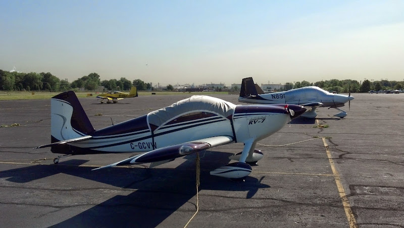
I?ve just returned home from the longest and probably the most exciting Cross Country trip I?ve ever undertaken to date. My Dad and I flew in my RV-7 from my home field just outside of Calgary to Washington, DC up to New York and back.
This trip write up isn?t going to be so much focused on our stops and the things we saw, the accompanying video will cover this, as much as it will be on my way of Cross Country flight planning and the enroute decisions I was faced.
I enjoy reading narratives about other intrepid aviators and the predicaments they get themselves it. There is usually a solution and a good lesson to be learned. My way of doing things isn?t going to be agreeable to all who read this. Your comfort level maybe different to mine and that?s fine. Safety is first, in all I do, and not once did I feel out of my comfort zone.
This maybe a bit lengthy, so grab your coffee, sit back and enjoy. Make sure to watch the video at the end.
Planning:
There are only two websites I use in my preliminary weather planning. The good ole? weathernetwork.com and unisys.com. The Weather Network gives a rough outlook for the week ahead, and Unisys Weather gives a graphic that shows moisture 5 days out. The Unisys graphic is amazingly accurate. I emphasize this as those who know me know my beliefs on weather forecasts. ?They are accurate 50% of the time?. I don?t hang my hat on anybody?s forecast as it?s nigh unto the impossible to predict weather days ahead.
Weather:
Most of us are amateur weather forecasters, and we need to be for the safety of our flights, but even the professionals can?t get it right more than half the time?..I think. Just my opinion.
What I really care about is, ?What is the weather doing RIGHT NOW?. Not what somebody forecasts in 6 or 12 or 24 hours.
I recently read a good article by J. Mac Mcclellan in Sport Aviation on weather. He shared something similar about forecasts. He said that it?s ok to take off for a flight if the weather is good where you are, even if the weather is forecasted to be marginal at the destination. Have an alternate and give yourself a way out, but there is chance that the forecasted bad weather may not materialize. So go fly and see for yourself.
So having said that, I usually wait until 5 days out before I even think about planning a route. I look for trends and see if I can ?predict? where a system may be moving.
As departure day draws near I refine my route but it?s always subject to change so I keep my options open.
Technology:
I use an Ipad 2 (Foreflight and Sky Charts) and XM weather in the cockpit. The XM is new and wonderful, but there are ways to gain the same information.
A good EFIS, Foreflight and SkyCharts are Gods gift to the Cross Country pilot. Those who have used them will agree and those who haven?t tried them don?t know what they are missing.
I Cached the US sectionals in the Ipad before I left so that I can access information in the air without the need for wifi or a network. Foreflight works good if you have a data plan but it costs $$ so I try to get as much information when I have a wifi connection. Most FBO?s have a free wifi connection.
Depending on the weather, I?ll pick my fuel stops in the air. Using SkyCharts and a couple of clicks I can pick an airport with 24 hour Self Serve fuel. With the EFIS showing fuel burn I can easily figure out range and then it?s just a matter of picking a place to stop. Usually 2.5 ? 3.5 hours is a good length.
My thoughts often drifted to those old time pilots who flew the same airspaces delivering mail. Only a compass and a map to guide them, I am amazed they arrived at their destinations. If I didn?t have my GPS I?d be screwed")
Water, Water everywhere:
In Rice Lake, Wisconsin the decision was made to fly straight over Lake Michigan and not go around the bottom of it. There are guys I spoke to, back at my home field, who knew my intentions to cross straight over the lake, and thought me suicidal. I couldn?t disagree with them more. My airplane doesn?t know what it?s flying over and the chance of my engine failing while I?m in the middle of the lake is tantamount to me winning the 50 Million Dollar lottery or being struck by lightning.
I don?t want to convey an air of cockiness or arrogance but one of confidence. I fly my RV a lot and with full engine instrumentation I know it well. I can dial the engine in to give me the best performance and fuel economy. The EFIS shows me all the engine parameters I want and as long as they are in the green, it?s a go.
We donned our life jackets, for safety, and in 20 minutes it was all over. No sweat. At RV speeds it doesn?t take long. It was kind of cool to see blue water in front, off the right wing, off the left wing and behind us.
First Diversion:
A weather check at the start of Day 2 showed that the rain showers were lingering in NYC. We were to go to NYC first but switched and decided to go to Washington, DC instead.
We left Saginaw, Michigan and picked a fuel stop in West Virginia. The Ipad and the XM were both showing some Marginal VFR condition in the Appalachian Mountains but good VFR beyond that.
There was a little drizzle and low clouds in Eklin-Randolph, WV and the Airport Manager (Dick Cheney ? no not the VP) helped us choose a path across the mountains. With this kind of weather, local knowledge was very helpful.
Dad and I weren?t sure if we were going to be able to cross the mountains, but as stated before, I see nothing wrong with going to ?have a look?, as long as there is a way out or the ability to do a 180 degree turn.
Our trek across the mountains was spectacular. Low clouds but beautiful rolling hills, absolutely gorgeous country to fly over. I kept saying to my Dad that this is Ultralight country. I?d love to jump in one of the old fabric covered birds and fly low and slow over this terrain checking it all out
To Be Continued.................
Years ago I read about a guy who flew his Beaver RX 550 Ultralight from Southern Alberta up to the Arctic Circle. At the time the ink was still wet on my Ultralight Permit and I couldn?t imagine doing such a trip. I didn?t even know where to begin. My Ultralight training taught me nothing about weather, navigation and radio work. It wasn?t until I finished my PPL that I had a basic understanding about these principles.
I?ve just returned home from the longest and probably the most exciting Cross Country trip I?ve ever undertaken to date. My Dad and I flew in my RV-7 from my home field just outside of Calgary to Washington, DC up to New York and back.
This trip write up isn?t going to be so much focused on our stops and the things we saw, the accompanying video will cover this, as much as it will be on my way of Cross Country flight planning and the enroute decisions I was faced.
I enjoy reading narratives about other intrepid aviators and the predicaments they get themselves it. There is usually a solution and a good lesson to be learned. My way of doing things isn?t going to be agreeable to all who read this. Your comfort level maybe different to mine and that?s fine. Safety is first, in all I do, and not once did I feel out of my comfort zone.
This maybe a bit lengthy, so grab your coffee, sit back and enjoy. Make sure to watch the video at the end.
Planning:
There are only two websites I use in my preliminary weather planning. The good ole? weathernetwork.com and unisys.com. The Weather Network gives a rough outlook for the week ahead, and Unisys Weather gives a graphic that shows moisture 5 days out. The Unisys graphic is amazingly accurate. I emphasize this as those who know me know my beliefs on weather forecasts. ?They are accurate 50% of the time?. I don?t hang my hat on anybody?s forecast as it?s nigh unto the impossible to predict weather days ahead.
Weather:
Most of us are amateur weather forecasters, and we need to be for the safety of our flights, but even the professionals can?t get it right more than half the time?..I think. Just my opinion.
What I really care about is, ?What is the weather doing RIGHT NOW?. Not what somebody forecasts in 6 or 12 or 24 hours.
I recently read a good article by J. Mac Mcclellan in Sport Aviation on weather. He shared something similar about forecasts. He said that it?s ok to take off for a flight if the weather is good where you are, even if the weather is forecasted to be marginal at the destination. Have an alternate and give yourself a way out, but there is chance that the forecasted bad weather may not materialize. So go fly and see for yourself.
So having said that, I usually wait until 5 days out before I even think about planning a route. I look for trends and see if I can ?predict? where a system may be moving.
As departure day draws near I refine my route but it?s always subject to change so I keep my options open.
Technology:
I use an Ipad 2 (Foreflight and Sky Charts) and XM weather in the cockpit. The XM is new and wonderful, but there are ways to gain the same information.
A good EFIS, Foreflight and SkyCharts are Gods gift to the Cross Country pilot. Those who have used them will agree and those who haven?t tried them don?t know what they are missing.
I Cached the US sectionals in the Ipad before I left so that I can access information in the air without the need for wifi or a network. Foreflight works good if you have a data plan but it costs $$ so I try to get as much information when I have a wifi connection. Most FBO?s have a free wifi connection.
Depending on the weather, I?ll pick my fuel stops in the air. Using SkyCharts and a couple of clicks I can pick an airport with 24 hour Self Serve fuel. With the EFIS showing fuel burn I can easily figure out range and then it?s just a matter of picking a place to stop. Usually 2.5 ? 3.5 hours is a good length.
My thoughts often drifted to those old time pilots who flew the same airspaces delivering mail. Only a compass and a map to guide them, I am amazed they arrived at their destinations. If I didn?t have my GPS I?d be screwed
Water, Water everywhere:
In Rice Lake, Wisconsin the decision was made to fly straight over Lake Michigan and not go around the bottom of it. There are guys I spoke to, back at my home field, who knew my intentions to cross straight over the lake, and thought me suicidal. I couldn?t disagree with them more. My airplane doesn?t know what it?s flying over and the chance of my engine failing while I?m in the middle of the lake is tantamount to me winning the 50 Million Dollar lottery or being struck by lightning.
I don?t want to convey an air of cockiness or arrogance but one of confidence. I fly my RV a lot and with full engine instrumentation I know it well. I can dial the engine in to give me the best performance and fuel economy. The EFIS shows me all the engine parameters I want and as long as they are in the green, it?s a go.
We donned our life jackets, for safety, and in 20 minutes it was all over. No sweat. At RV speeds it doesn?t take long. It was kind of cool to see blue water in front, off the right wing, off the left wing and behind us.
First Diversion:
A weather check at the start of Day 2 showed that the rain showers were lingering in NYC. We were to go to NYC first but switched and decided to go to Washington, DC instead.
We left Saginaw, Michigan and picked a fuel stop in West Virginia. The Ipad and the XM were both showing some Marginal VFR condition in the Appalachian Mountains but good VFR beyond that.
There was a little drizzle and low clouds in Eklin-Randolph, WV and the Airport Manager (Dick Cheney ? no not the VP) helped us choose a path across the mountains. With this kind of weather, local knowledge was very helpful.
Dad and I weren?t sure if we were going to be able to cross the mountains, but as stated before, I see nothing wrong with going to ?have a look?, as long as there is a way out or the ability to do a 180 degree turn.
Our trek across the mountains was spectacular. Low clouds but beautiful rolling hills, absolutely gorgeous country to fly over. I kept saying to my Dad that this is Ultralight country. I?d love to jump in one of the old fabric covered birds and fly low and slow over this terrain checking it all out
To Be Continued.................