What's new
Van's Air Force

Don't miss anything! Register now for full access to the definitive RV support community.

Crossing the Rockies

AndyRV7

Well Known Member
I'm trying to find out what I would need to plan for or get additional training for if I wanted to fly across the country. I guess I can't get the phrasing correct because I can't find any discussion using the search.

Does anyone have any info or advice? Would be NJ to the NoCal area and back.

Thanks! Andy
 
You don't really need any additional training besides that which you learned getting your PPL, provided you have been trained in flying over the type of terrain you will be flying over. Thus, if your goal is to get to the other side of the Rocky Mountains you should either (a) get at least a little bit of instruction in mountain flying or (b) simply route south of the Rocky Mountains. I'd do (a) just to pick up more skills, but there's no reason you can't do (b). Beyond that, just consider longer cross-countries as being small cross-countries strung together. Same rules (weather, flight planning, etc.) apply.
Good luck!
 
Andy,
There are numerous threads about crossing the Rockies and routes across the rockies. I don't know how much cross country time you have, or if you have an instrument rating. A fairly simple rule to follow is fly only on a severe clear day, before noon with a surface wind less than 20 KTs. If you cross north, follow highway 80 or 90 or the victor airways that essentially do just that. You can easily cross at 12,000 feet.
I have crossed numerous times in numerous places in much less capable aircraft than the RV. There are several books on the subject. Check with Sportys. The mountain flying handbook is just one.
 
If you are from point A to point B Andy get an oxygen bottle and enjoy the ride.


If you are looking for a low level adventures take some mountain training. It could get rough quickly.


I flew my 3 from SF to Philly and back this year. You can search rph142 for my trip reports. I flew the northern route heading east and the southern route heading west. You can avoid most rough terrain with careful planning.
 
Just remember the Rockies are not the only mountain range you will cross.
Nevada is the most mountainous state in the nation.
Do your homework, Read or better yet take a mountain flying course
from someone like Bill Schroeder (www.flightsafetycounselor.com).
Also think about oxygen and cold as well as survival equipment.
Have fun. It is very pretty country.
 
I have flown to OSH 3 times, once southern route in my old 1948 Stinson, and twice pretty much direct from home in the RV 10. We cross the Rockies close to Rock Springs WY------nice tail wind heading east.

By all means, stay on top of the weather forecast, and be aware that things will change rapidly in the area, fly morning if you can.

Good luck, fly safe.
 
While all these suggestions in re mountain flying have a ton of merit when flying from coast to coast, I feel that a very important item has been overlooked.

Convective weather in the Midwest needs to be addressed as it can be severe if not prepared.

That said, if proper planning has been accomplished, the trip between coasts will be not only safe, but one of the most enjoyable trips you will ever make.
 
Mountain Flying Bible

The Mountain Flying Bible by Immelson (sp?) really helps you get a grasp of the issues and some great rules of thumb IMHO. I also got some instruction at Jackson Hole when I was there on a family vacation. As one who has ventured into the Rockies on my own just twice, the biggest challenges were high winds on landing and taking off heavy at 6000' or more. You really have to be willing to adjust your plans as you go based on weather in my very limited experience, but that can add to the fun.

John
 
Last edited:
IFR (I Follow Roads)

Many Rockies crossings in the past 38 years from Cessnas to RV's. I always felt safer flying over freeway which were built at lower elevations and provided a convenient landing strip for emergencies. Thankfully never had to use same.

Turbulence in C-172 was not comfy at all and seldom an issue up higher in RV.

Jerry
 
With modest amount of flying in the mountains of Colorado I can tell you that following the highways are not always the best idea. We have had numerous wrecks by people trying to follow I70 and could not make it over Vail pass or even worse, trying to clear the mountains over the Eisenhower tunnels. The best way is to follow the colorado river past Eagle, kremmling, Granby, all with good runways, then get hi and go over Corona pass. 13.5 will get you over in good shape. A word of warning,,,,, in winter the wind aloft there can be quite strong so the higher you get the smoother the ride and hold that altitude until you get past the front range. Also, get flight following, so can get past denver class B. And yes, I've O2 in my 7 and been as high as 17.5 without smokin anythin
 
my 2 cents

If you've never been to a high (density) altitude airport, at least remember to use indicated airspeeds for approach and takeoff. True airspeeds will be higher and so it will look different, because it is different! Resist the temptation to slow down on approach, or to rotate too soon on takeoff.
Make sure you know how to lean for max power if the density altitude is high enough.
I strongly encourage you to take O2 and fly high. In general it will be more pleasant, and you have more options if things go wrong, be it a strong downdraft or outright engine failure. If the headwinds are so strong that ground speeds are too slow to bear, land and wait. If you fly low on days like that ground speed will be better but you'll likely get beat up.
 
I have always lived by the rule of "dress like you are going to have to walk home"
I have crossed the Rockies several times over the years and never had any problems but remember you can have a lot of headwind going west.
 
Fly the southern route. Much lower altitudes and warmer. Never need O2, then turn north in southern CA to get to where you want to go. It may be a little longer but much safer and more comfortable.
 
rockies

Not sure when you are planning to fly but I am at the base of the wind rivers which is on the east side of the Rockies. Field elevation is 7280'. I am a bush pilot in Alaska and have extensive back country flying both in the Rockies and Alaska. If you wanted to come this way you are more then welcome to stop by and I could spend a little time with you. Giving this time a year you do have a few advantages and disadvantages with the mountains. I am close to Yellowstone park and Jackson Hole Wyoming. Beautiful country around here.
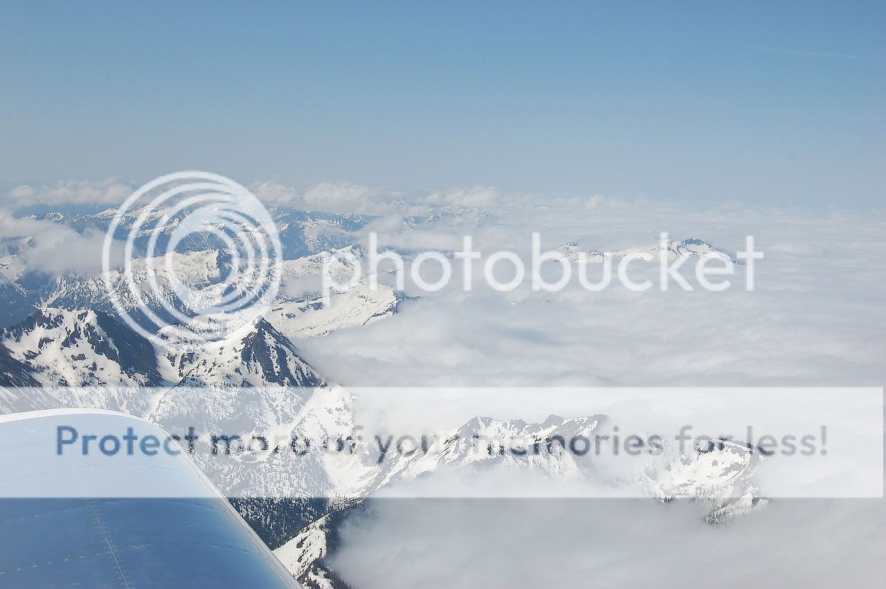
Vlad your picture is somewhere around the Wyoming and Montana boarder area
 
vlad

Vlad your first two pictures are south east coast area of Alaska and the last one is Wyoming Montana boarder area possibly Idaho Montana boarder area. Great area both of them.
 
Vlad your first two pictures are south east coast area of Alaska and the last one is Wyoming Montana boarder area possibly Idaho Montana boarder area. Great area both of them.


Look similar isn't it Bruce? They are somewhere nr Idaho/Montana border Anaconda Range I believe. I just left Brian Carrol at Townsend westbound it was 2012.


Your Alaska mountains are these. On the way back from you I ended up at an altitude I would never normally go. Couldn't wait to be back you are a great host! :D


Turbulence in C-172 was not comfy at all and seldom an issue up higher in RV.

Jerry
Turbulence in an RV crossing the Rockies is not very comfy either. Even with supplemental O2 and going up high I still got the snot beat out of me. Ground speed heading eastbound was good, but the best thing is to follow the age-old advice of get your flying across the Rockies done early in the morning. Twice I've done it in the afternoon in the middle of June and Einstein's definition of insanity comes to mind. I'll not be trying that a 3rd time :eek:
 
Wow...great information in here! Thanks for all the suggestions and offer for help. I see I have some more planning to do before I try this. I have about 10 days off soon and thought I might like to see California but I am going to push this back and plan a trip for 2015. Thanks again for the great thread! Andy
 
I have been in N Nevada 15 years now and often see 150+MPH winds over the ridge tops before storms move in, I like the above post follow a highway, I 80 may be a good route. When ever if cross the sierras I bring my survival pack and snow gear. And as mentioned, fly early. :)
 
I have been in N Nevada 15 years now and often see 150+MPH winds over the ridge tops before storms move in, I like the above post follow a highway, I 80 may be a good route. When ever if cross the sierras I bring my survival pack and snow gear. And as mentioned, fly early. :)

If you follow I-80 the daily NWS soaring forecast for Reno will give you a better winds aloft and thermal turbulence prediction.

http://www.wrh.noaa.gov/total_forecast/getprod.php?wfo=rev&sid=rev&pil=srg
 
Back
Top