

To all our SkyView customers, SkyView software version 4.0 is now available.
4.0 Adds:
Basemap: Roads, rivers, cities, railroads, etc. This is a free database, available worldwide in high resolution.
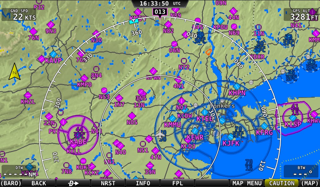
Greatly enhanced mapping visuals: Graphics that match the style and color of sectional type charts. This includes shaded, dashed and other airspace depictions, greatly enhancing in-flight awareness. European airspace details have been added to reflect all airspace categories.
Check out the new map:
AHRS Cross-Checking: Multiple AHRS units are now constantly cross-checked in the background and will alert the user if they do not agree. The user is then presented with a simple display of both attitude solutions so they can choose the correct one.
Enhanced Network redundancy: The system now utilizes a fully redundant power and data network between the SkyView screens and modules. This prevents almost all single wire failures from causing a loss of data.
Visit the download link here: http://www.dynonavionics.com/docs/support_software_SkyView.html
4.0 Adds:
Basemap: Roads, rivers, cities, railroads, etc. This is a free database, available worldwide in high resolution.
Greatly enhanced mapping visuals: Graphics that match the style and color of sectional type charts. This includes shaded, dashed and other airspace depictions, greatly enhancing in-flight awareness. European airspace details have been added to reflect all airspace categories.
Check out the new map:
AHRS Cross-Checking: Multiple AHRS units are now constantly cross-checked in the background and will alert the user if they do not agree. The user is then presented with a simple display of both attitude solutions so they can choose the correct one.
Enhanced Network redundancy: The system now utilizes a fully redundant power and data network between the SkyView screens and modules. This prevents almost all single wire failures from causing a loss of data.
Visit the download link here: http://www.dynonavionics.com/docs/support_software_SkyView.html
Last edited:

") . What does that look like?
. What does that look like?
