What's new
Van's Air Force

Don't miss anything! Register now for full access to the definitive RV support community.

Plattsburgh, NY area air to ground photos needed

Bubblehead

Well Known Member
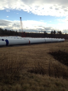
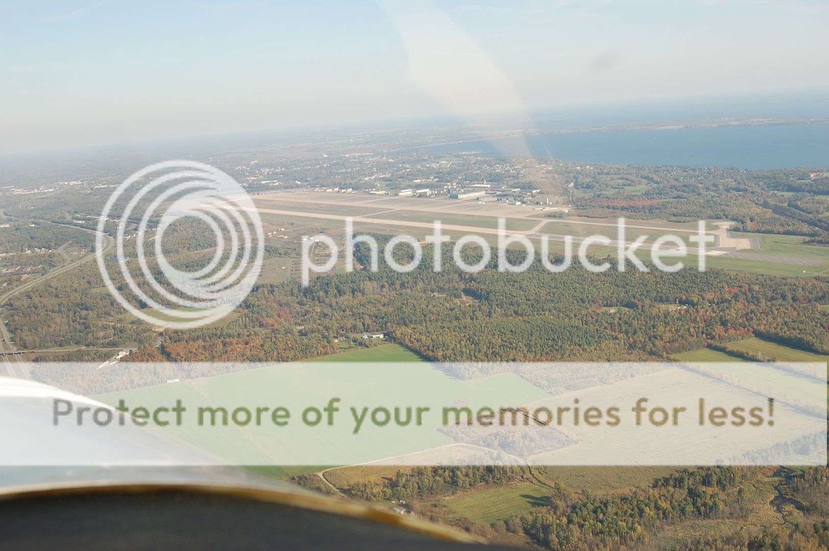
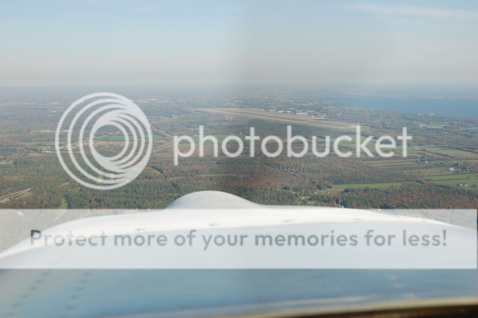
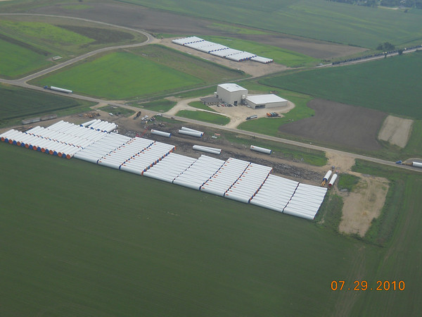
My company is operating a small construction site near the Plattsburgh NY airport and a few aerial photos would be very helpful.

It would not have to be from an RV, although I take a lot of photos of our sites from my RV-8 with just a pretty basic hand held digital camera. Obviously Cubs and Champs and high wing planes in general do great with this.

I live in TX and the site's in NY so it's not practical this time of year for me to fly up and do the pictures my self.

I can be reached at 512-850-8339 or [email protected].

Thanks,

John
 
Google Earth?

Glenn,
I deal with this also, on my architectural day job. The problem is that Google Earth doesn't update their photos often enough to show things like construction progress. The best you'd get is a picture of the basic lot, empty field, or tops of the trees, whichever is the case, until the next time they update their database. Aerial photos can be taken at an oblique angle, showing what is under the trees.

In Upstate NY? All you'd see is trees...and lots of 'em...
 
Link to Map

We just started the site in early December so unless the satellite photo has been updated it won't do me any good. We've unloaded 100 tower sections and I need a picture from the air to get a feel for how much useful space remains.

Here's a link to a Google map showing where we are working.

http://g.co/maps/wv3ne

To give you an idea of what we are doing there, here is a picture taken at ground level on the site.

i-jHNqnMG-L.jpg
 
John I might have some images of this place. I visited two months ago will check pictures tomorrow. Will be there again late Jan early Feb let me know if you still need shots. I am not a good photographer though and my Nikon is aged :)
 
We just started the site in early December so unless the satellite photo has been updated it won't do me any good. We've unloaded 100 tower sections and I need a picture from the air to get a feel for how much useful space remains.

Here's a link to a Google map showing where we are working.

http://g.co/maps/wv3ne

To give you an idea of what we are doing there, here is a picture taken at ground level on the site.

Side note.. Microsoft has some nice aerial photography imagery, usually with perspective, for a lot of the US too...here is your site:

http://binged.it/rWIo8g

....and you can zoom in another 2x beyond that. Real nice for getting to know an unfamiliar airport too... :)

But, doesn't help you in your real-time situation, I know.
 
Last edited:
John I might have some images of this place. I visited two months ago will check pictures tomorrow. Will be there again late Jan early Feb let me know if you still need shots. I am not a good photographer though and my Nikon is aged :)

That would be grate Vlad. I don't really need pictures from earlier this year, I really need new pictures taken this weekend or early next week.

Any time you get up there I would be glad to have some pictures and contribute to the avgas fund. If anyone wants to stop at the airport let me know. I'll have my site manager pick you up and give you a ground level tour of the site.


Oh it's here small Earth John :D I am very familiar with this piece of aviation history.


6183b07b.jpg


I will be there after New Year. Will call you on exact date. If anybody from your company has better camera then D50 welcome aboard :)
 
DCat22 - Those photos are much better than the Google ones. Thanks for sending me the link.

Vlad - you must have been almost right over the site when you took that picture! I'll check with my manager to see what camera he has. He might not want to go fly with you, besides, he's about 250 lbs! Heck, I might send you my spare to use for a while.
 
John where exactly is the site?


c4f8e3ef.jpg


No need for spare camera Cousin just got brand spanking new SuperTripleDLSDR with IStelezoomVR I will talk him into it :D
 
The site can be found on Google maps through this link
http://g.co/maps/wv3ne

Its at the Southwest corner of the airport, just off airport property. If you look at a road map you look for railroad tracks just east of I-87.

Look for a bunch (100) of big white tubes laying on their sides in neat rows. It should look something like this except with more trees!

952102131_CgSkE-M.jpg


This picture was taken from my RV at about 800 to 1000 AGL, flaps 20 degrees, trimmed for about 90 kts and about 30 degrees of bank.

I really appreciate the help.
 
Back
Top