I recently replaced my GNS430 (non WAAS) with a GNC355. After a few flights I have a couple questions.
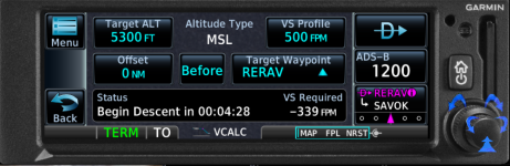
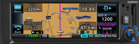
My GNS430 had a feature that displayed Vertical Speed Required (VSR) which I used to determine when to start my descent. It planned to the last waypoint in a flight plan or a direct to waypoint. The GNC355 has a similar feature using the VCALC utility. But I have not been able to make it work unless I go to the utility and input the waypoint. The Pilot Guide implies that last waypoint in flight plan or direct to is the default setting. Is this normal?
I have GRT EFIS that the GNC355 displays on. A few times I've input a direct to in the GPS and the waypoint data box on the EFIS displays the correct heading, distance and time but displays ALT rather than the waypoint (airport) name. After a few minutes, ALT gets replaced with the proper name. Is this normal?
Thanks for the help.
Jim Butcher