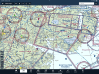
I learned to fly before there was GPS and the last time I flew was 20 years ago so I'm totally out of the loop on the new GPS navigators, auto pilots, etc. As I start to get caught up on what's new in avionics since I last flew I've done some cross country trip planning using some free online tools. I plan to install a full Garmin suite in my -14 but I haven't subscribed to Garmin Pilot yet so I have no experience with it other than watching YouTube videos. There seems to be one thing missing in all the videos I've watched and that's "customized auto-routing".
For example, when doing trip planning using ground based mapping/navigators (e.g. recreational vehicle trips), you can choose to avoid highways, dirt roads, toll roads, set height restrictions for bridges, etc and the navigator will provide a route that matches your criteria. Do any aviation products do this? It seems like there should be a way during flight planning to check boxes for avoiding certain types of airspace (TFR's, MOA's, Class B, etc), adding minimum AGL altitudes, etc along the route and have the navigator plot that route. One more thing I think the avionics should do is allow you to send this customized route to the autopilot and have the autopilot fly that route. Again, in the videos I've watched I don't see this capability either.
Am I missing something or do I just need to wait another 20 years for these features to show up?
Last edited:
")