

n5lp
fugio ergo sum
My typical flights probably aren't much like most builders would envision. I do a lot of local reconnaissance and photography, and it works best when it is mostly unplanned.
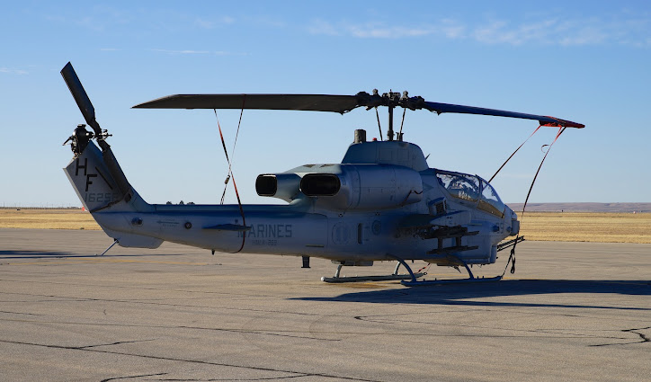
First to go to the airport and see if anything interesting is happening. At my airport there usually aren't many people, but today there are some interesting helicopters that I am not used to. Super Cobras of some variant, I think.
I, like many of you, live in a karst area. That means there are caves and sinkholes everywhere. There are so many that I certainly am not familiar with even a small fraction of them, but I do try. I also try to keep a good file of aerial photos of the major cave entrances in the area. One of my recent missions was down to the Balmorhea area of West Texas to take a better photo of Phantom Cave, which is a big deal right now in the caving community due to a recent fantastic deep dive expedition http://www.admfoundation.org/projects/phantomcave2013/phantom2013.html
Today, I thought I might fly up north of Roswell to photograph the entrance to a very interesting gypsum cave named Torgac. On the way I could get Bottomless Lakes and Bitter Lake Wildlife Refuge and maybe some fantastic dikes called Railroad Mountain and El Camino Del Diablo. The Devil's Highway looks like a paved road and goes for 10's of miles; it is an amazing sight.
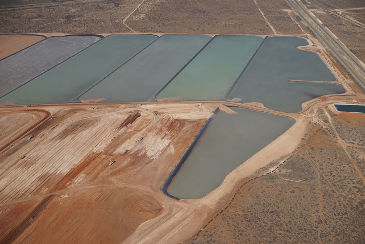
First I wanted to check on some evaporation ponds northeast of town. This is a solution mining project that floods old potash mines with saltwater which removes and replaces the potash in the pillars and such and then is evaporated on the surface and refined.
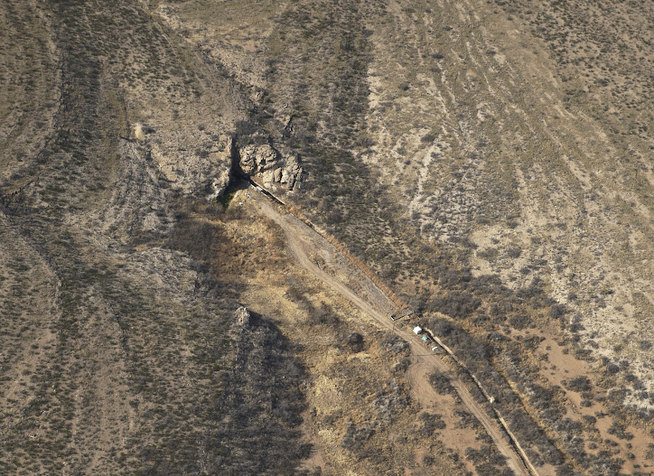
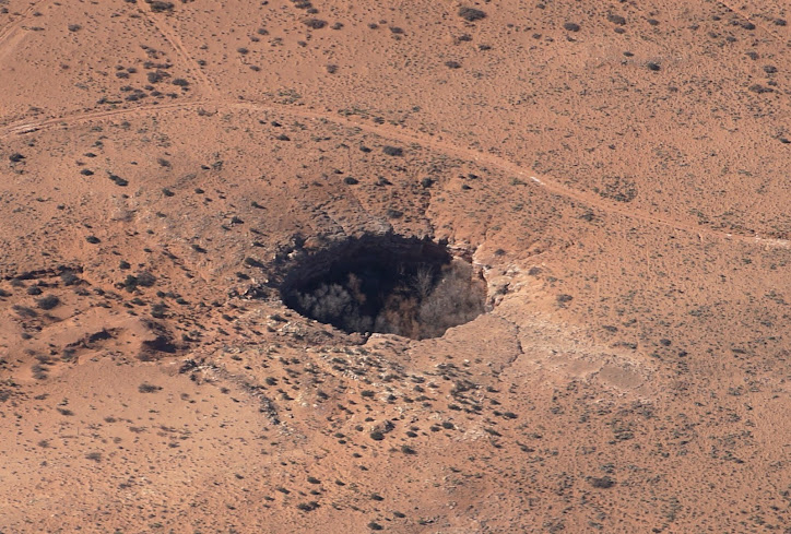
On the way out to check the progress of the construction of the evaporation ponds, I noticed a hole. Now there are lots of holes but I am familiar with most of them out this way. This hole seemed to have very sharp edges and to be undercut. Maybe it is new. I got the coordinates for later investigation.
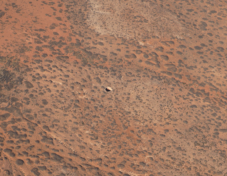
After looking at the pond progress I turned north for the Roswell area. It immediately became apparent that the controllers there were slammed with T-34Cs in all directions. Well, that's ok, I don't need to talk to Roswell. On the way up that way, I saw another unfamiliar big sinkhole. This one is obviously very old though, with trees growing in it.
I continued north and it started to get unpleasant. It was windy at Carlsbad but not very bumpy. It got bumpier and bumpier and there was lots of blowing dust, so I took a poll of everyone on board and we decided to retreat to Carlsbad for terrestrial investigations.
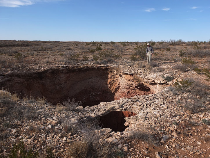
I checked out land ownership, road access and such and got a friend to go with me to check out the first sinkhole.
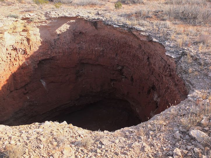
The thing about recording a location on the ground by RV is it is not very precise, since you can't see what you are recording and there are various delays that add up at 150 MPH. That means there is still some sport in finding the hole. We were able to find the hole in a reasonable time and found it pretty impressive.
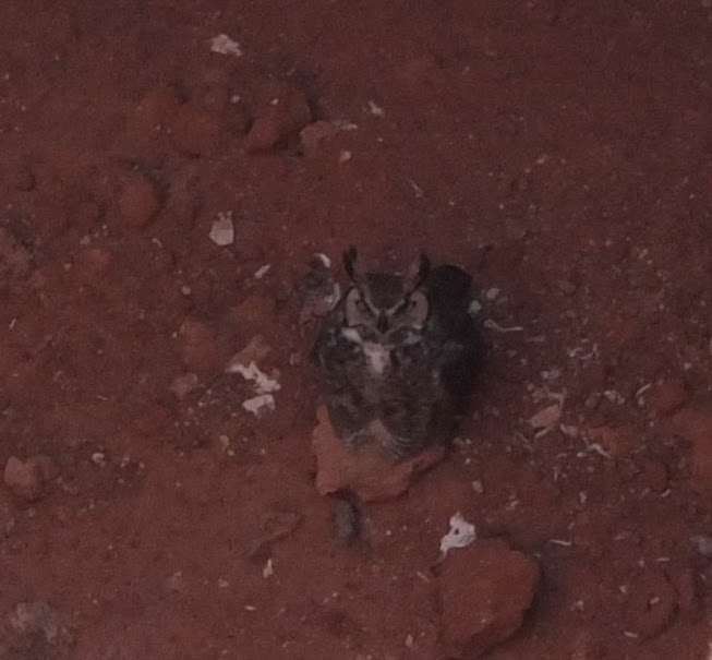
The owner of the hole was a great horned owl who regarded us with some skepticism.
Typical day. Wishy washy plans subject to change at a moments notice and loads of fun.
First to go to the airport and see if anything interesting is happening. At my airport there usually aren't many people, but today there are some interesting helicopters that I am not used to. Super Cobras of some variant, I think.
I, like many of you, live in a karst area. That means there are caves and sinkholes everywhere. There are so many that I certainly am not familiar with even a small fraction of them, but I do try. I also try to keep a good file of aerial photos of the major cave entrances in the area. One of my recent missions was down to the Balmorhea area of West Texas to take a better photo of Phantom Cave, which is a big deal right now in the caving community due to a recent fantastic deep dive expedition http://www.admfoundation.org/projects/phantomcave2013/phantom2013.html
Today, I thought I might fly up north of Roswell to photograph the entrance to a very interesting gypsum cave named Torgac. On the way I could get Bottomless Lakes and Bitter Lake Wildlife Refuge and maybe some fantastic dikes called Railroad Mountain and El Camino Del Diablo. The Devil's Highway looks like a paved road and goes for 10's of miles; it is an amazing sight.
First I wanted to check on some evaporation ponds northeast of town. This is a solution mining project that floods old potash mines with saltwater which removes and replaces the potash in the pillars and such and then is evaporated on the surface and refined.
On the way out to check the progress of the construction of the evaporation ponds, I noticed a hole. Now there are lots of holes but I am familiar with most of them out this way. This hole seemed to have very sharp edges and to be undercut. Maybe it is new. I got the coordinates for later investigation.
After looking at the pond progress I turned north for the Roswell area. It immediately became apparent that the controllers there were slammed with T-34Cs in all directions. Well, that's ok, I don't need to talk to Roswell. On the way up that way, I saw another unfamiliar big sinkhole. This one is obviously very old though, with trees growing in it.
I continued north and it started to get unpleasant. It was windy at Carlsbad but not very bumpy. It got bumpier and bumpier and there was lots of blowing dust, so I took a poll of everyone on board and we decided to retreat to Carlsbad for terrestrial investigations.
I checked out land ownership, road access and such and got a friend to go with me to check out the first sinkhole.
The thing about recording a location on the ground by RV is it is not very precise, since you can't see what you are recording and there are various delays that add up at 150 MPH. That means there is still some sport in finding the hole. We were able to find the hole in a reasonable time and found it pretty impressive.
The owner of the hole was a great horned owl who regarded us with some skepticism.
Typical day. Wishy washy plans subject to change at a moments notice and loads of fun.

