What's new
Van's Air Force

Don't miss anything! Register now for full access to the definitive RV support community.

APRS loop of the USA

Sam Buchanan

been here awhile
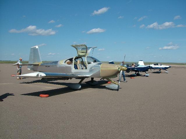
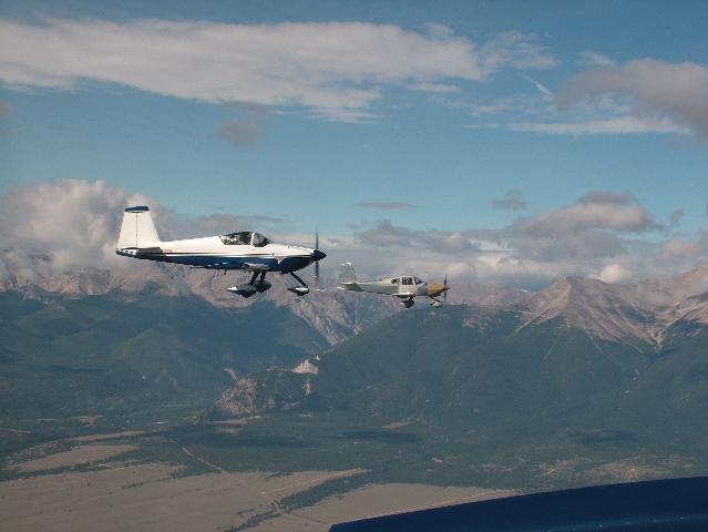
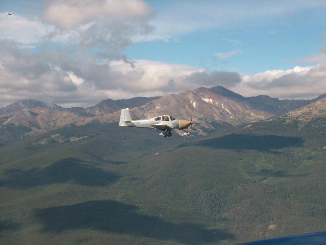
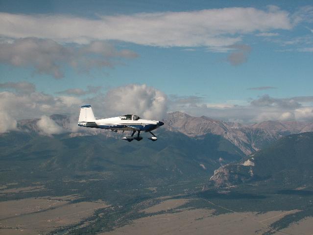
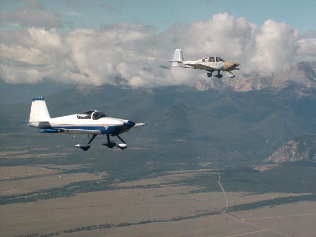
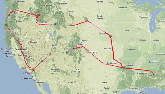
A gaggle of four RV's departed Alabama this morning for a grand tour of the USA:

West%20map%208-24.jpg


The route will proceed in a clockwise direction around the map.

One of the aircraft, an RV-10, is piloted by Doug Preston and he has an APRS tracker onboard. I don't know details of the APRS installation but so far it seems to be working fine:

http://aprs.fi/?call=N372RV&mt=p&z=10&timerange=3600

My hangar-mates, Bob and Ginger Butler (RV-6A) are planning to blog the trip:

http://bobandgingerwest.blogspot.com

It should be interesting to follow this flock for the next two weeks. :)
 
A visit??

Let us know if you have time for a visit our would like a place to stay, Independence is between Newport and Aurura.
 
Sam.... check out my posting on KRAP (Rapid City, SD) in the SD area...

http://www.vansairforce.com/community/showthread.php?t=11923&highlight=KRAP

Try for the Alex Johnson Hotel through the FBO....:)

Let us know if you have time for a visit our would like a place to stay, Independence is between Newport and Aurura.

Thanks for the invite, but I'm not on the trip. :(

Doug Preston may monitor this thread during the evenings, however.
 
APRS put to practical use

When Sam posted the link for Doug's APRS track, I saw them near Amarillo TX. After a bit of judging to determine if I could get to La Junta just before them, I went to the airport and flew down. I tried to reach them on 122.75 but to no avail. Then I switched between 122.75 and LHX unicom. I was a bit past LHX when I finally heard Doug. We coordinated our entries and I got into downwind a mile ahead of Doug.

Here they are on the ramp at La Junta:

Preston1Small.jpg
 
Leadville

Here are two of the group heading north towards Leadville CO (LXV)

Preston2Small.jpg


Here is Doug

Preston3Small.jpg


I notice that their path is not far from Death Valley (L06). Sure would be a shame to fly into the highest airport in the CONUS and miss flying into the lowest (-210 feet).

Do it Doug. Death Valley. I hear it calling your name.

"Doug....come land here."
 
Link doesn't work, Sam

.....it just takes me to the APRS site. What do we do then? I'm green to all this,

Thanks,
 
I get the same thing, but if you do the search for his tail number, you will find his track "N327R"
 
When it asks for a login, just put in anything there. Then search for N372RV in the search field after the google maps interface comes up.

It appears that they are stuck in Gunnison, either by choice it WX, as the west part of the state is overcast this afternoon.
 
When it asks for a login, just put in anything there. Then search for N372RV in the search field after the google maps interface comes up.

It appears that they are stuck in Gunnison, either by choice it WX, as the west part of the state is overcast this afternoon.

Yep, just talked to Bob and scattered rain showers in the valleys have caused them to overnight in Gunnison. They may take the Durango-Silverton narrow-gauge train excursion tomorrow while waiting for better weather.

I also talked to Doug and got some info on his tracker. Still don't know which xmitter he has (I suspect MT-300), but a ham buddy of his rigged up an "all in one" box that is velcroed along with the little antenna to the windshield post of the RV-10. It seems to be working quite nicely considering the small antenna inside the plane.
 
I checked the APRS link when I got home and noted a 180 turn. Knowing the possible bad weather I checked ADDS then called Doug and they did divert to Gunnison for weather.

My guess is that a two week trip will have its share of changes...some or most weather related.

There are numerous missing locations/plots. Some indicated a different path than we took but still this system appears to be far better than an ELT.
 
Last edited:
We had a great day Saturday. Covered almost 1000 kts from EET to LHX. Landed behind Ron about 1530 MT. Stayed overnight at the Stagecoach Motel. They were kind enough to pick us up at the airport and take us back this morning. Nothing fancy, but seemed clean enough & I slept fine. We covered almost 1000 kn with flight time od 6+39. Made 2 stops to eat and fuel. We departed LHX about 0800 this morning and met Ron & Stewart over 00V at 12,500. Headed for Pikes Peak, shot some pics then up the valley to LXV. All was uneventful and beautiful WX. LXV was not as bad as we expected. Ron gave us all some tips since he is experienced in that part of the country. We greatly appreciate Ron & Stewart being our tour guides. Well, then we headed for CNY but as we approached MTJ the 496 showed us the bad news. We decided to go into GUC. Talked to FSS and decided to RON. We are stuck with the rooms at CNY and may have to drive to Durango tomorrow so as to avoid paying for rooms there for 2 nights. If so we will drive back to GUC Wed. morning and hopefully continue as planned. Ya'll do a sun dance for us.
Bob, if things work out we would love to visit with u and take u up on your offer for overnight if able. Please send me an email & phone #. Maybe u could give us some info for your area.

Regards,

Doug Preston
[email protected]
N372RV
 
If the tour can make a stop in Lincoln, NE I'll buy dinner! (KCEK or KLNK) 100LL is pricey, but I can bring my 100 gallon tank and pump 92 mogas for $3.85.
 
Last edited:
APRS loop

It looks like they are back in the air again. According to their blog, they parked their planes at Gunnison, CO and then used rental cars and took the Durango-Silverton train ride and then returned to Gunnison last night. Their blog indicates their intended destinations today...Monument Valley for breakfast and then on to Bryce Canyon.
This APRS technology is really neat! (Except when you're in the middle of nowhere (SE Utah) and there are no igates close by! Of course, if Doug had a belly antenna, it might work better...)
Don
(Studying for the exam) :cool:
 
Last edited:
Also looks like a 30 minute plus dropout in coverage after Dove Creek CO.

Yep, looks like the geography may be more than Doug's very minimal APRS installation can handle. Should get better as he gets closer to some populated areas.
 
Probably right Sam. I doubt that he is flying over 12,500'. Plus he may have the 300 mW version.

I just talked to Doug and the "coverage" issues may have to do to a power connection problem. They are in Bryce and apparently had a good day.
 
Last edited:
Greetings Doug...I see that you are getting closer to me

Please stop by and say hello. I know you have places to go but I would like to see you and your group. Just land. Take a few pictures...then on to Catalina Island.

Your friend

Furnace Creek Airport
L06 (L zero 6)
Death Valley CA
 
APRS Loop of the U.S. continues

They're on the move again...I just checked on them and as of right now they are approaching San Bernadino. Hopefully, there'll be more stations in Southern California to receive their transmissions.
Don
P.S. In the above link, just insert any "call sign" or "nickname" for the login.
P.P.S. Update: as of 20:49Z they are getting real close to the Pacific Coast. Next stop appears to be Catalina Island. What a trip!!! Sam, I tried the sectional overlay and it is quite amazing. However, on my computer (which is supposed to be very fast ;) )the APRS updates seem to be very slow. Are you able to track near-real time with the Google Earth overlays including the sectionals?
 
Last edited:
APRS Loop of the U.S.A.

Looks like they made it to Santa Catalina Island. The last packet I can read is stamped at 2008-09-05 21:08:17z and 105 MPH 165° alt 10745 ft.

That was more than 30 minutes ago as I write this, and it looks like they were maneuvering for the downwind at KAVX. Weathermeister indicated winds of 250* at 10 knots would be favoring runway 22.

What a trip!

Don

P.S. They made a quick trip from Santa Catalina Island back to Big Bear City before sundown. It's amazing how much ground (and water) an RV can cover in two or three hours. Have I said it before? "What a Trip!"
 
Last edited:
What a trip!!! Sam, I tried the sectional overlay and it is quite amazing. However, on my computer (which is supposed to be very fast ;) )the APRS updates seem to be very slow. Are you able to track near-real time with the Google Earth overlays including the sectionals?

Watching them fly up the Owens Valley getting ready to cross the big rocks:

aprs-google-4.jpg


Google Earth seems to work well.......most of the time. Sometimes it just flat-out hangs and needs a restart to get sorted out and tracking again. Seems to be more of a problem when there has been many minutes between received beacons--maybe the server is timing out or something. Don't think it's a problem with your machine but rather a server/software glitch. The most reliable tracks still are on aprs.fi but the sectional overlay on Google is still impressive and useful.

Doug's improvised tracker seems to be struggling at times, looks like it may be having some GPS issues, lots of beacons with no MIC-E data. Would have been nice to have a first-rate tracker installation on the trip so we could check for coverage holes but guess we will just have to be content with watching the gang have a great trip. :)
 
Last edited:
Devil's Tower

Doug, looks like you are close enough to fly over Devil's Tower on your way to Mount Rushmore.

It is about 10 miles WSW of Hulett (W43)
 
Last edited:
Looks like Doug landed about ten minutes ago near Jasper AL.

Ron, Doug has now arrived back at Shelby County (EET) his home field. Bob is still in Mena, AR (flat tire this afternoon) hoping to beat Ike tomorrow.

Here is a composite I assembled of the APRS track (click for a larger version):

APRS-loop-USAsm.jpg


Even though Doug's tracker was not a robust installation, the overall performance was pretty good. The gaps occurred where we expected them--the hole in Nebraska is now well-documented. You mentioned the gap in Utah was probably due to a loose power cable. Looks like western Wyoming was void but haven't spoken to Doug about whether or not the tracker was functioning on that leg.

Looks like a great trip and hopefully everyone can get home safely soon. (update; Bob and Ginger arrived at DCU 9/13/08)
 
Last edited:
Back
Top