aadamson
Well Known Member
http://www.aero-news.net/index.cfm?ContentBlockID=b6f2a2b8-642a-4edf-8b25-6796564cdd23&
Just saw on aero-news.net
Just saw on aero-news.net


haven said:Why is it, that there are few reports about planes being found based on the ELT. It just seems this thing never works.
jcoloccia said:The problem with the 121.5 ELT's isn't triggering the ELT itself. The sattelite tracking is horribly flaky, bordering on useless, and triggers many false alarms. With the new ones, you'll truly be able to pinpoint (I use that term loosely) the aircraft position and it should be much more robust to false triggering.
az_gila said:Don't the new ones transmit a unique ID and GPS co-ordinates?
gil in Tucson
I think you may be right re: the ID. I'm really not sure.Definitely right about the ID; a 406 MHz ELT is programmed with a unique code that gets registered with NOAA - they run the SARSAT system.jcoloccia said:Nope re: the GPS
n5lp said:We got a full briefing on the search at the EAA meeting tonight at Carlsbad. I will leave out a couple of things they specifically asked as to not repeat, there is still quite a bit of information.
There were 14 search planes on the ramp tonight and they expect around 20 tomorrow. A larger scale thing than I expected. All the airplanes are Cessnas except for the Australian GR-8 that has some high tech sensing equipment.
The CAP guy said they are usually searching for someone with under 500 hours. This ferry pilot has around 26,000 or 27,000 hours, retired military and airline, mid 70s age.
The weather was good except for being windy. Peak gusts in nearby Guadalupe Pass on the order of 90 knots.
They showed us the ground track, which they got today. He was traveling just about due east and went over the north edge of the cultivated fields around Dell City, Texas. Radar contact was lost at about 8,000 feet on the west end of the Guadalupes, the normal place to lose radar contact at that altitude. The next place there would be radar contact at 1,000 agl would be at about the New Mexico/Texas border over in the Jal, Eunice, NM area, so that is the area they plan to search. They have concentrated on the Guadalupes so far and there has been some ground searching going on in the Guadalupes also. They have already found many airplane wreckages in the Guadalupes, but there are many there and all those so far have been accounted for.
Some possible scenarios were discussed; about what you could come up with. A point of interest is that the pilot reportedly fit very tightly in the cockpit, for headroom.
Some good things: The pilot is known to often carry survival equipment and was dressed warmly as the RV supposedly didn't have a heater (I'm guessing maybe it just didn't work well) and of course he has the military survival training.
Hoping for the best.
He had hoped to get a very early start but did some work on unspecified mechanical problems that delayed him. He had made one stop at Marana Northwest Regional, near Tucson.Bob Martin said:...
I don't know how many times he stopped on his way from CA but he had to be making good time and a long day for sure...
n5lp said:How much headroom one has would depend on how the airplane is set up, as well as the size of the pilot.
None that I know of.TSwezey said:Any RV's out there looking for him?
Having done a little search work from an RV, I know visibility may not be that of a -182 or similar. But covering ground at 180-190 mph can sure make up for restricted visibility. And having 2, 3, 4+ extra pairs of eyes out there obviously helps.n5lp said:None that I know of.
They have made it clear here that they don't want anything but CAP planes in the areas where they are searching and they are searching in the most likely areas.
I understand their reasons for that but know of another search in New Mexico where an active duty Air Force pilot, after offering help, was basically sent to where there was no chance he would find the wrecked aircraft.
He did that for a while then did some investigating on his own. He was the one that found the wreckage, with his RV, one of the poorer search planes I can think of, and with no observer help.
n5lp said:I will leave out a couple of things they specifically asked as to not repeat, there is still quite a bit of information.
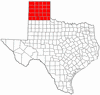
Small area?? It looks like he could be anywhere in the Texas panhandle. That's 10-15,000 sq miles. Give or take a few.TShort said:........I agree about additional help; I can see why they wouldn't want everyone and their brother out in a small area, but it seems like more eyes and more planes would be better if people were coordinated in the search.
Thomas
So coordinate the volunteers. Assign grid areas and altitudes. Require two person crews - one fly, one observe.gorbak said:.....The last thing CAP needs are well wishers blasting through an area where each Observer and Scanner are concentrating looking at the ground (and not another flight in the area). The Pilot is concentrating on flying a proper grid, controlling slow flight and maintaining a very narrow altitude range in bumpy conditions.
sure have. Even while the person in the left seat trying to kill me for hours at a time! I.e., flight instruction!!Have you practiced precision slow flight for 3 to 4 hours at a time? This is hard work.
gorbak said:.....
The G8 Airvans are equiped with the ARCHER sytem, Airborne Real-time Cueing Hyperspectral Enhanced Reconnaissance camera. If CAP knows the paint code on the missing aircraft, this can be loaded into the computer system and this paint color will be located if they fly over it. (Cessna white differs from other manufacturers white, etc.) This is a very technical piece of equipment and only CAP offers it for SAR and Homeland Security.
......
Pat Garboden
Ozark, MO
I've been following CAP's implementation of this system for some time. It promises to really improve the ground-searching capabilities of CAP. This, along with the ability to real-time link hi-res digital images from the aircraft along with ADS-B like equipment could really make a big difference in what CAP can do. These systems are way ahead of what we had in the mid 1990s, when we were happy to have a LORAN in the aircraft and forget actually having a dedicated FM radio or a decent intercom system that made it easy for the observers to talk to the mission comm folks (ARRGH! Did NXXXXX miss roll call again? Do I presume them missing?)gorbak said:The ARCHER system is such a hyper sensitive system that it really can determine the difference between Ford blue and GMC blue on a car while flying overhead. ....It is a great system to assist in many missions, including SAR.
Low Pass said:Small area?? It looks like he could be anywhere in the Texas panhandle. That's 10-15,000 sq miles. Give or take a few.
!I also have not been filing flight plans & resist it for the same reasons. But I have been following this thread and thinking about things that might make flying without a flight plan safer. Some of these have been mentioned and maybe other more experienced pilots can add to the list:n5lp said:I could file a flight plan for every flight but if I did that I would have to give up flying. To me, flying is mostly about the freedom. Take off, go somewhere, discover what is there and follow the lead of what you find.
Great ideas. Only comment is there are some very remote parts of this country even today. I am guilty of taking some direct routes over the Cascades and Sierra Nevada mountains that put me over remote tough terrain. In this case they lost the radar and there was NO radio calls? It could be physical incapacitation. I hope not in this case and hope for the best, but sometimes planes are not found. I agree the new gen of ELT's should give you a better chance of being found. I assume they will have similar problems of not activating like current ELT's. It does not matter how wizzbang the electrics are if they never get turned on.GrayHawk said:I also have not been filing flight plans & resist it for the same reasons. But I have been following this thread and thinking about things that might make flying without a flight plan safer. Some of these have been mentioned and maybe other more experienced pilots can add to the list:
- Give copy of your flight plan to several people (Aeroplanner ceates a pdf file).
- Flight following wherever possible
- Position reports on a regular basis, to nearest FSS, if possible. I understand this can be done without a filed flight plan.
- Pireps on a regular basis
- Cell phone calls at every stop to flight plan recipients.
- At airports along the way give position & direction advisories. Not logged but maybe some one will remember.
- Maybe be proactive and migrate to the newer ELT systems.
One more item to add:GrayHawk said:- Give copy of your flight plan to several people (Aeroplanner ceates a pdf file).
- Flight following wherever possible
- Position reports on a regular basis, to nearest FSS, if possible. I understand this can be done without a filed flight plan.
- Pireps on a regular basis
- Cell phone calls at every stop to flight plan recipients.
- At airports along the way give position & direction advisories. Not logged but maybe some one will remember.
- Maybe be proactive and migrate to the newer ELT systems.

