

My RV-6 has been flying in the LA Basin for over 13-years. Today weather was SEVERE CLEAR with visibility UNLIMITED. Days like to day only occur for the Rose Parade or about once a year. Today was one of the first days that I flew my RV-6 for fun and not on a mission. (DAR inspection, Formation Practice, Formation Air Show, Formation Checkride, demo flight, post maintenance test flight, training, etc.) I enjoyed my RV-6 more today than any day in recent history. I put it away with 2,470 hours on the hobbs.
I took off behind a friend that was flying his C-172 solo. Typical departure at KCCB (elevation 1,440) is runway 24 with a climbing left 270 over the approach end of 24 for a north departure. This keeps us out of ONT Charlie airspace. I crossed over 24 climbing through 3,300. (takeoff was full fuel solo) I was 1,000' higher than my fiend in his C172. I contacted SoCAL Approach on 125.5. (SoCAL, RV157GS VFR Request). SoCAL said go ahead with request. RV157GS, off Cable climbing through 3,500, RV6/G, request flight following Camarillo, 6,500) I got a request approved standby for squawk code. A little bit later, I had a squawk code and radar contact.
Level at 6,500, I was in awe at the view. I have seen it before but views like this only occur once or twice a year. (Typically Rose Bowl Parade weather including high temperature in the low 80s.) You could see Catalina Island 22 miles off the coast.
The canopy and my iPhone 3G does not do justice to the view or the feeling of freedom that I was feeling and desiring to share with you.
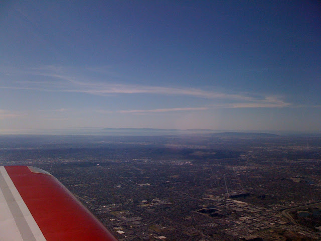
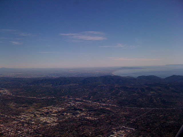
Dodger Stadium and downtown LA.
My route of flight too me right over Burbank Airport. You can see Burbank Airport just over the nose. (I am starting to wonder if that is Van Nuys and not Burbank.)
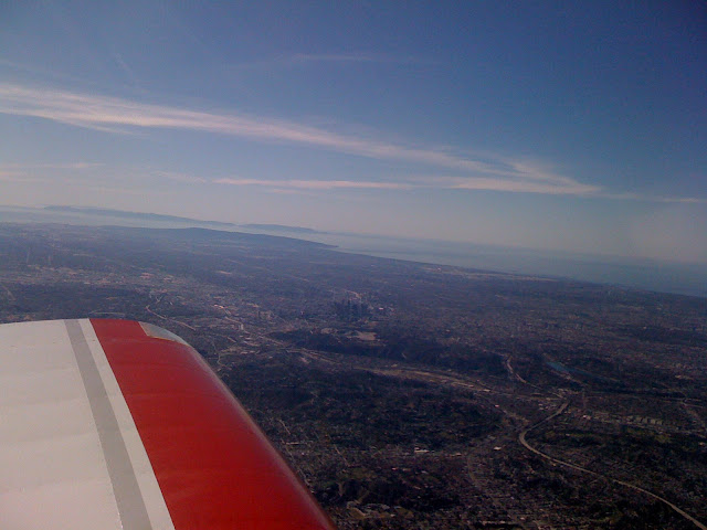
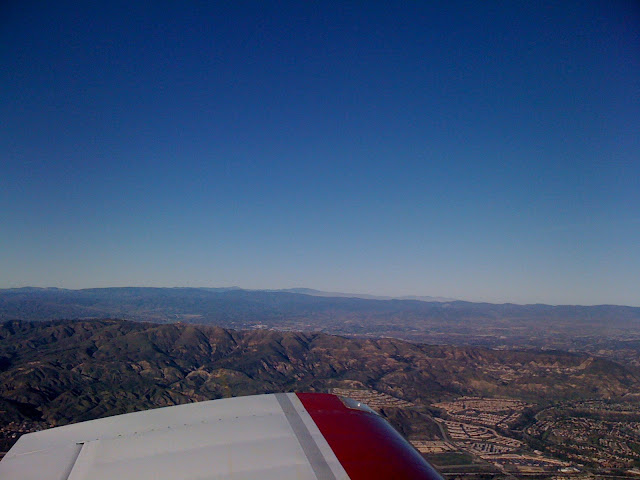
And the San Gabriel Mountains to the north.
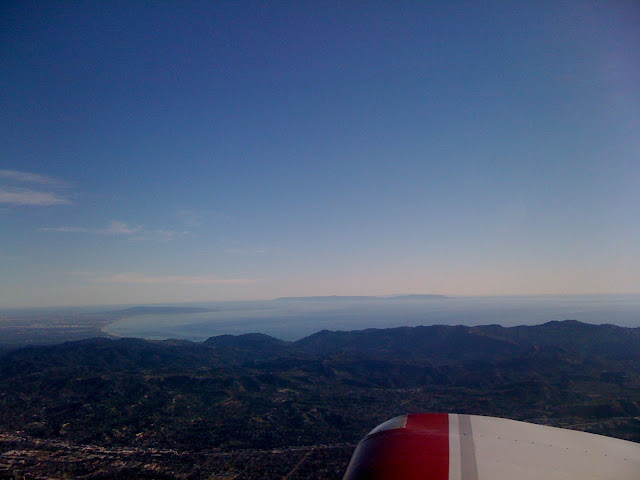
Looking south, LAX can be seen. (the white concrete area near the coast just over the ridge line) Yes that is Catalina Island on the right side of the photo.
During the 30 minute fight, I talked to 5 different SoCAL controllers on 5 different frequencies and Point Mugu Approach on another. About 7 miles from CMA, I was told to squawk VFR and contact the tower on 128.2. Tower was busy but I was able to get my call in 5.5 miles out. I was immediately told to reduce speed to approach speed. (I was turning 2,100 RPM and pulling 22 inches of manifold pressure. In my decent through 2,500, I had 170 Knots over the ground according to my GPS.) I pulled the throttle back to 5 inches and slowed down as I continued my decent to 877 MSL. Traffic was called for me on the 45 and I began looking. It was "Cougar" was also inbound and "Cougar" turned the smoke on for me to see. On downwind, I was cleared to land as number two behind the RV ahead. I responded to the tower "Cleared to land behind company traffic. 7GS." Abeam the approach end of runway 8, tower asked me to extend down wind 1/4 mile so that they could get an Eclipse departure out. I extended downwind and tower called my base and cleared me to land again. The Eclipse was still sitting on the numbers as I turned final and began my slip to lose altitude. The Eclipse started rolling and tower told me to do S-Turns for spacing. At 65 KIAS, I did maybe one S-turn and headed toward the runway as I saw light under the Eclipse. After touchdown, tower told me to exit at Charlie and contact ground when able. I responded "right on Charlie, ground on point 8 off the active, 7GS." Contact with ground cleared me to taxi restaurant by Foxtrot. I responded "Taxi Foxtrot to the restaurant behind company traffic."
At the transient parking area, Cougar and I got our airplanes secured and up taxied "Lucky". We did not hear "Lucky" on the radio but he shut down his tailwheel RV-6 just like I did. He pulled the mixture while he was taxiing and hit the brake to turn 90 degrees for parking just as the prop stopped. Once "Lucky" got his head set off, "Cougar" make the comment that both of us were show-offs since you are not able to do that in "Cougar's" RV-6A.
The Restaurant was busy as usual and there was a 30 minute wait for the 4 RVers that showed up. Peter has his RV-4 based at CMA and made his first flight yesterday. Peter talked with Laird and myself about his flight and his heavy left wing.
After a great lunch with friends, we all went our separate ways. I met up with a co-worker that has his Diamond Motor Glider based there and we visited, talked about airplanes for about an hour.
The fight home was just as beautiful. More photos.
Newhall Pass.
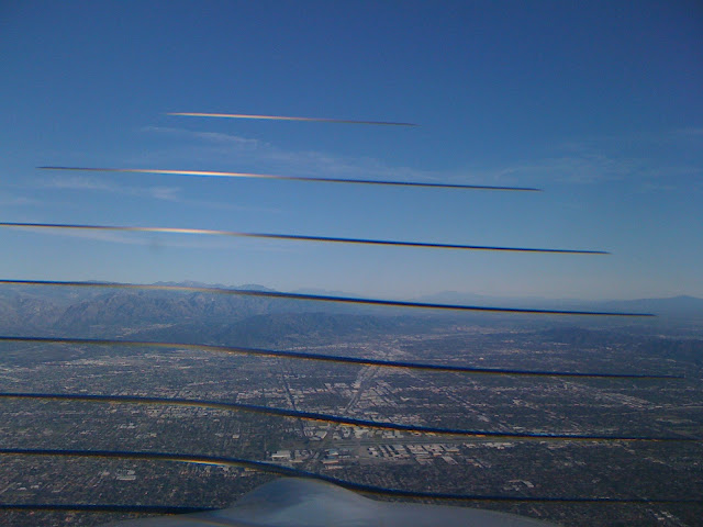
More Catalina Island and LAX. (This was taken right after SoCAL vectored me to fly 130 for a departing Citation and told me to resume own navigation.)
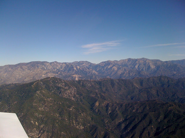
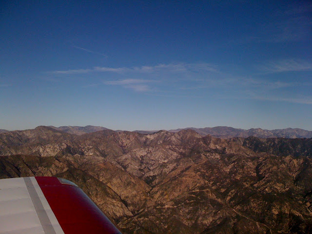
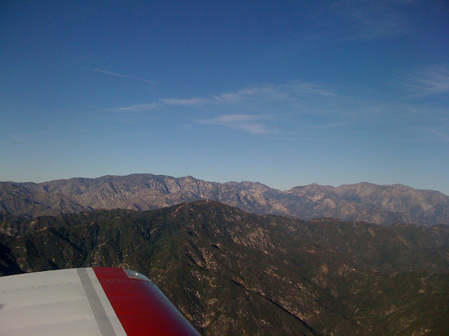
More San Gabriel Mountains.
I did not see any photos that show how many houses there are in the LA basin. I moved here 27 years ago from Pennsylvania after learning to fly at 2G3 (now KVVS). Life here is very hectic and I am ready to consed that the rats won the rat race. I am eligible for early retirement in about 500 days but who is counting. I am ready to relocate to an area that has a slower pace of life but not sure I can afford it. Flights like today is how I cope with the rat race and am ready to report back to work with new sense of worth.
I enjoyed flying today a LOT. I hope by sharing my enjoyment I am able to give you some enjoyment.
Thanks Van for designing such a wonderful aircraft, making my dream of owning and flying my own airplane possible, and for making it possible to meet all the great people in the RV family.
Thanks Paul "Ironflight" Dye for giving me the courage to write this.
I took off behind a friend that was flying his C-172 solo. Typical departure at KCCB (elevation 1,440) is runway 24 with a climbing left 270 over the approach end of 24 for a north departure. This keeps us out of ONT Charlie airspace. I crossed over 24 climbing through 3,300. (takeoff was full fuel solo) I was 1,000' higher than my fiend in his C172. I contacted SoCAL Approach on 125.5. (SoCAL, RV157GS VFR Request). SoCAL said go ahead with request. RV157GS, off Cable climbing through 3,500, RV6/G, request flight following Camarillo, 6,500) I got a request approved standby for squawk code. A little bit later, I had a squawk code and radar contact.
Level at 6,500, I was in awe at the view. I have seen it before but views like this only occur once or twice a year. (Typically Rose Bowl Parade weather including high temperature in the low 80s.) You could see Catalina Island 22 miles off the coast.
The canopy and my iPhone 3G does not do justice to the view or the feeling of freedom that I was feeling and desiring to share with you.
Dodger Stadium and downtown LA.
My route of flight too me right over Burbank Airport. You can see Burbank Airport just over the nose. (I am starting to wonder if that is Van Nuys and not Burbank.)
And the San Gabriel Mountains to the north.
Looking south, LAX can be seen. (the white concrete area near the coast just over the ridge line) Yes that is Catalina Island on the right side of the photo.
During the 30 minute fight, I talked to 5 different SoCAL controllers on 5 different frequencies and Point Mugu Approach on another. About 7 miles from CMA, I was told to squawk VFR and contact the tower on 128.2. Tower was busy but I was able to get my call in 5.5 miles out. I was immediately told to reduce speed to approach speed. (I was turning 2,100 RPM and pulling 22 inches of manifold pressure. In my decent through 2,500, I had 170 Knots over the ground according to my GPS.) I pulled the throttle back to 5 inches and slowed down as I continued my decent to 877 MSL. Traffic was called for me on the 45 and I began looking. It was "Cougar" was also inbound and "Cougar" turned the smoke on for me to see. On downwind, I was cleared to land as number two behind the RV ahead. I responded to the tower "Cleared to land behind company traffic. 7GS." Abeam the approach end of runway 8, tower asked me to extend down wind 1/4 mile so that they could get an Eclipse departure out. I extended downwind and tower called my base and cleared me to land again. The Eclipse was still sitting on the numbers as I turned final and began my slip to lose altitude. The Eclipse started rolling and tower told me to do S-Turns for spacing. At 65 KIAS, I did maybe one S-turn and headed toward the runway as I saw light under the Eclipse. After touchdown, tower told me to exit at Charlie and contact ground when able. I responded "right on Charlie, ground on point 8 off the active, 7GS." Contact with ground cleared me to taxi restaurant by Foxtrot. I responded "Taxi Foxtrot to the restaurant behind company traffic."
At the transient parking area, Cougar and I got our airplanes secured and up taxied "Lucky". We did not hear "Lucky" on the radio but he shut down his tailwheel RV-6 just like I did. He pulled the mixture while he was taxiing and hit the brake to turn 90 degrees for parking just as the prop stopped. Once "Lucky" got his head set off, "Cougar" make the comment that both of us were show-offs since you are not able to do that in "Cougar's" RV-6A.
The Restaurant was busy as usual and there was a 30 minute wait for the 4 RVers that showed up. Peter has his RV-4 based at CMA and made his first flight yesterday. Peter talked with Laird and myself about his flight and his heavy left wing.
After a great lunch with friends, we all went our separate ways. I met up with a co-worker that has his Diamond Motor Glider based there and we visited, talked about airplanes for about an hour.
The fight home was just as beautiful. More photos.
Newhall Pass.
More Catalina Island and LAX. (This was taken right after SoCAL vectored me to fly 130 for a departing Citation and told me to resume own navigation.)
More San Gabriel Mountains.
I did not see any photos that show how many houses there are in the LA basin. I moved here 27 years ago from Pennsylvania after learning to fly at 2G3 (now KVVS). Life here is very hectic and I am ready to consed that the rats won the rat race. I am eligible for early retirement in about 500 days but who is counting. I am ready to relocate to an area that has a slower pace of life but not sure I can afford it. Flights like today is how I cope with the rat race and am ready to report back to work with new sense of worth.
I enjoyed flying today a LOT. I hope by sharing my enjoyment I am able to give you some enjoyment.
Thanks Van for designing such a wonderful aircraft, making my dream of owning and flying my own airplane possible, and for making it possible to meet all the great people in the RV family.
Thanks Paul "Ironflight" Dye for giving me the courage to write this.


