RudiGreyling
Well Known Member
Hi RVators,
Well on the spur of the moment my good friend convinced me to fly to his house at Marloth Park next to the Kruger National Game Park in South Africa.
A quick check in with Weather Office, drop my little one of at the Grand Parents and fuel up the RV and we are ready to go. Take off and check in with ATC Flight Information and Radar, requested flight level?Scenic") My wife has not seen this area from the sky so our RV treated her to some good views.
My wife has not seen this area from the sky so our RV treated her to some good views.
We Flew over Bronkhorst Spruit Dam, Loskop Dam Valley, then onto Blyde Poort Canyon:
Go here for my flight tracking, register and log in, look for ?Rv7? on 11 and 12 April, it is online for 30 days before expiring: http://www.vfrplanner.org/tracker/index.php
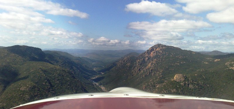
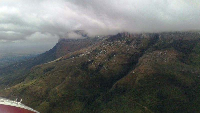
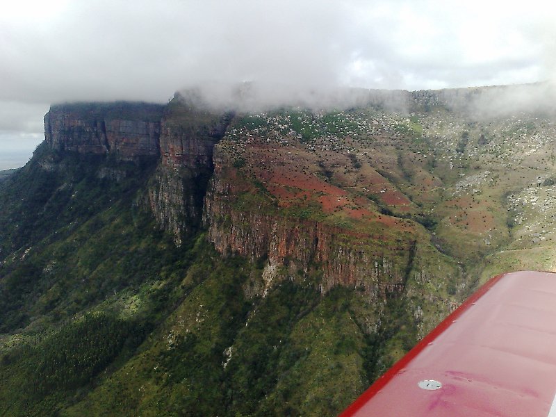
Coming up to Blydepoort I could see over the top it is clear on the other side, but the scattered puffy clouds hung close to the escarpment face. I know the area fairly well so after a quick chat to ATC, I decided to drop into the valley that run into the Blydepoort Canyon, just underneath the puffy clouds. My wife has not seen this area before from the sky so she had no idea what waited!
Coming up to Blydepoort Canyon just underneath the clouds.
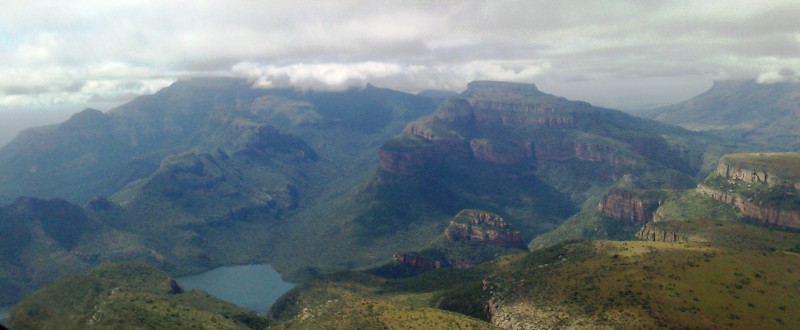
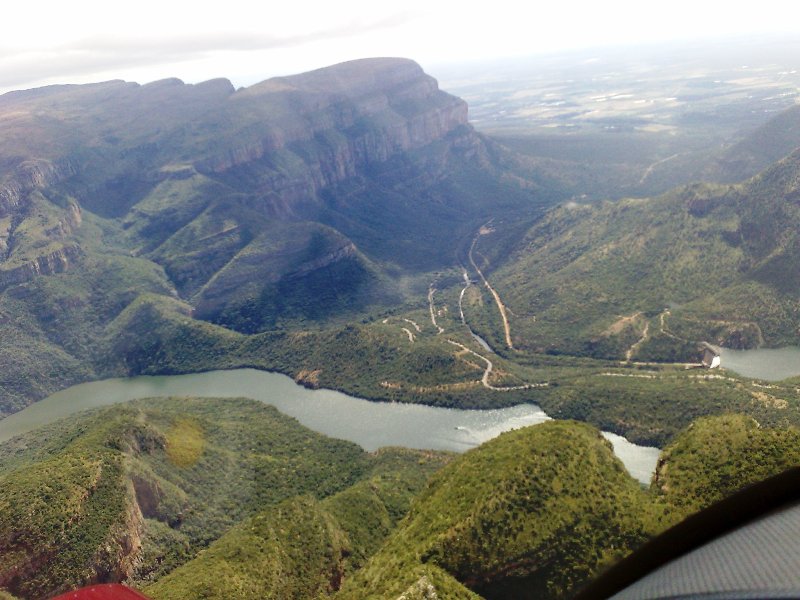
The tourist lookout point for this area is on the flat mountain to the right:
The Blydepoort dam
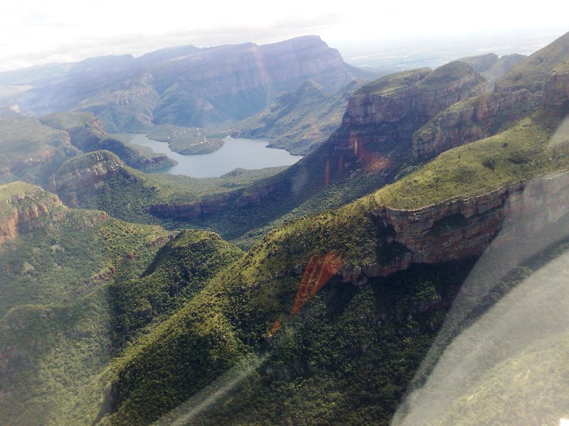
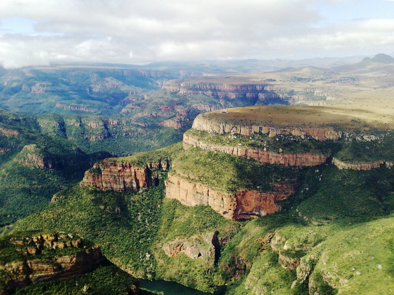
More Blydepoort
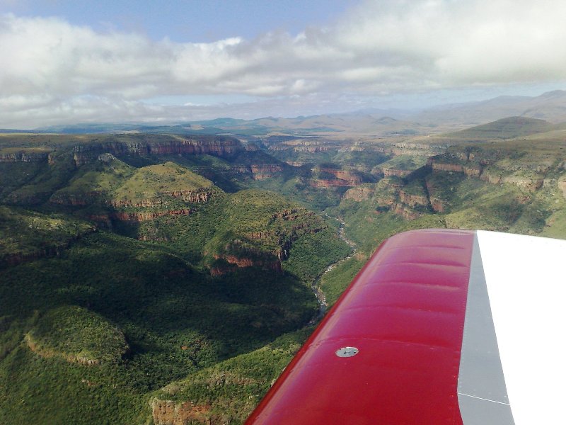
Then we flew all along the escarpment cliff face, just below the clouds. To the right is the escarpment cliff to the left it drops away 3000 ft into the flatlands, and clear skies. We passed the ?God?s window? lookout point which was covered in cloud.
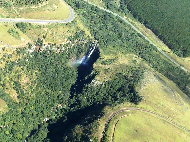
Then the cloud started to disappear and we could view some of the waterfalls at the Graskop area.
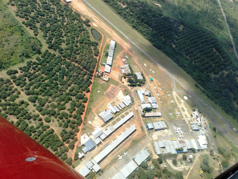
We followed the escarpment south all along to Sabie, then over Nelspruit airport before setting course east again to Komatie Poort.
to continue...
Well on the spur of the moment my good friend convinced me to fly to his house at Marloth Park next to the Kruger National Game Park in South Africa.
A quick check in with Weather Office, drop my little one of at the Grand Parents and fuel up the RV and we are ready to go. Take off and check in with ATC Flight Information and Radar, requested flight level?Scenic
My wife has not seen this area from the sky so our RV treated her to some good views.We Flew over Bronkhorst Spruit Dam, Loskop Dam Valley, then onto Blyde Poort Canyon:
Go here for my flight tracking, register and log in, look for ?Rv7? on 11 and 12 April, it is online for 30 days before expiring: http://www.vfrplanner.org/tracker/index.php
Coming up to Blydepoort I could see over the top it is clear on the other side, but the scattered puffy clouds hung close to the escarpment face. I know the area fairly well so after a quick chat to ATC, I decided to drop into the valley that run into the Blydepoort Canyon, just underneath the puffy clouds. My wife has not seen this area before from the sky so she had no idea what waited!
Coming up to Blydepoort Canyon just underneath the clouds.
The tourist lookout point for this area is on the flat mountain to the right:
The Blydepoort dam
More Blydepoort
Then we flew all along the escarpment cliff face, just below the clouds. To the right is the escarpment cliff to the left it drops away 3000 ft into the flatlands, and clear skies. We passed the ?God?s window? lookout point which was covered in cloud.
Then the cloud started to disappear and we could view some of the waterfalls at the Graskop area.
We followed the escarpment south all along to Sabie, then over Nelspruit airport before setting course east again to Komatie Poort.
to continue...
Last edited: