When I set out on a long cross-country, I usually have a plan for the route, fuel stops, and alternates. I’ve looked at the weather “big picture”, and know whether or not I can expect to complete the trip VFR or if I am going to have to file IFR for some (or all) legs. In the RV, I started out looking at 500 mile legs, but have gained enough confidence in the fuel burn to be very comfortable planning 600 – 700 mile segments, leaving me at least an hour of reserves – plenty good enough if I have VFR weather at the destination. (I leave a little more “fat” in the tanks if it looks like the arrival will be IFR, as I really like to have enough in the tanks to go find a VFR alternative if I can’t get in to the planned destination.) I like cruising in the low teens if I can get a nice wind assist, because even though I loose some knots of TAS above 10K, the fuel burn goes way down and the range goes way up – it is common to see 1000 miles of range on the EFIS after I have leveled off at 13.5K.
Of course, once I get in the air, real-time changes have to be made to the preflight plan, and that is where flexibility comes in to play. As weather changes and wind affect the course of the flight, I frequently change fuel stops – and sometimes I do it for purely economic reasons. It is not uncommon for airlines to “tanker” fuel when they can get it cheaper at certain locations, and I am not averse to saving a dollar per gallon (easy to do these days) – especially when I am taking on more than half of a full load! A good example was my recent trip to California for the weekend.
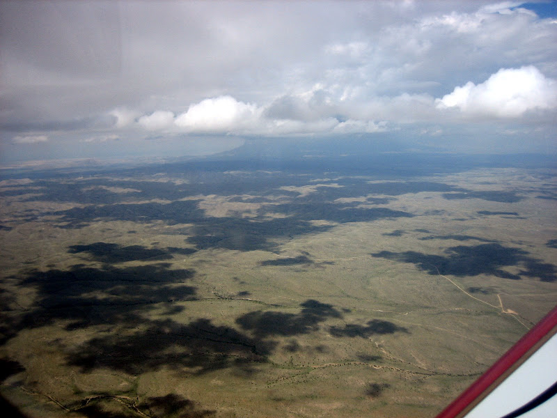
The distance from Houston to Big Bear Lake in California is about 1100 nautical miles. Assuming that I can easily make a 600 mile leg, the trip should be a “two-hopper” in reasonably benign wind conditions, as are frequent this time of year. The El Paso area is about halfway, and there are several potential fuel stop destinations. I always carry an AirNav printout of fuel prices along the route, and this can help save considerably. My plan this time was to make a stop to visit with RV-8 Builder Tom Navar at his airpark west of El Paso (just north of the LOE site), have some lunch and take advantage of his generous offer of reasonably-priced fuel. With Weathermeister calling for a total trip length of a little more than 6:30 that day, I should have been able to make the mid-point and the destination with more than an hour of reserve. I set out with this as a working plan, but aware that the only weather along the way was a line of weak showers around Deming, about 60 miles west of Las Cruces. This area was predicted to be unstable later in the day, so I planned to keep an eye on it.
Sure enough, as I progressed across the vast open distances of west Texas, I could see the north/south line of showers developing as predicted. The line got wider, and individual cells began developing and drifting slowly to the north, as the line very slightly shifted to the east. I didn’t want to take a chance of coming up on the weather low on fuel if the line shifted east and over my fuel stop, so I decided to make a pre-emptive stop at Pecos – about 45 minutes short of the middle, and more expensive – but that would allow me to deal with the weather with full tanks, giving me more options for deviations. I called Tom from Pecos (cell phones really are great tools!) and apologized for not being able to drop in, but he was very understanding of my rationale, and concurred with my plans – besides, he knew I’d be out for LOE, and I’d see him then. The quick turn at Pecos allowed me to be on my way and headed for the weather in no time.
Coming up on El Paso, the XM Nexrad was still showing a nice green-only break in the line of weather around Deming, conveniently on I-10, which is on flat terrain. Deming itself was calling 4,000 scattered at the time, and the visibilities were good. But just as I was ready to commit to a low-altitude highway run, things changed suddenly – DMN went down to IFR, and a red cell developed right on top of it. The line of showers extended from just south of the Mexican border up to about 50 miles north of DMN, then there was a break before the line continued well to the north. The clearest option looked to be a deviation north, around the line, but something just didn’t seem right about that – the terrain rose rapidly north of DMN, up to mountains in the teens – just about where the break in the line was appearing. Experience told me that either the weather really was open there – or (more likely) there was no (or unreliable) radar coverage at that point. I didn’t want to deviate towards rising terrain only to find bad weather, and lose my opportunity to get through. To the south of Deming, there was a nice spot of green precip over a mostly flat area of lower terrain. The elevations were showing on the chart to be less than 5,000’ (except for the hills just south of Deming itself). Taking the low road was the way to go – no matter how much we harp the altitude ability of the RV’s, they aren’t going to top 20K+ cumulus!
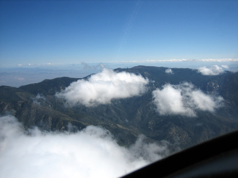
Having terrain displayed on my EFIS, and the XM to show me the weather, I set an absolute hard-deck of 6,000’ and descended towards the light precip. As I approached, I could see hills on both sides of my route on the EFIS, and decided I would get no closer than 1500’ to the terrain (vertically), and five miles horizontal. Sure enough, I was below the clouds with those clearances as I entered light rain, and in a couple miles, I was out the other side – all the time maintaining legal VFR visibility. All I had to do was make sure I avoided the tethered balloon restricted airspace on the far side, and I was home free. Clear of the weather, I climbed back up to 10.5K and the computer said that I’d have 7 gallons of fuel remaining at Big Bear. Hmmm….awful tempting to go direct, non-stop from Pecos to California, but AirNav had the normally low-priced Big Bear at $4.08 per gallon, while Casa Grande (south of Phoenix, and a nice fuel stop) at $3.75. I hate to add an additional descent and climb to a flight (I figure that’s a half hour ), but since I wasn’t in a hurry, saving the money was a good idea, so a three-hopper it was going to be. Big Bear turned out to be wide open weather-wise, but had some interesting winds as I arrived – variable from 320 to 080 degrees, at 12, gusting to 26. To be honest, while the winds were tricky, this flat-lander was more worried about landing at 7,000’….but all went well, and no brakes or tires were traumatized in the arrival.
Of course, once I get in the air, real-time changes have to be made to the preflight plan, and that is where flexibility comes in to play. As weather changes and wind affect the course of the flight, I frequently change fuel stops – and sometimes I do it for purely economic reasons. It is not uncommon for airlines to “tanker” fuel when they can get it cheaper at certain locations, and I am not averse to saving a dollar per gallon (easy to do these days) – especially when I am taking on more than half of a full load! A good example was my recent trip to California for the weekend.
The distance from Houston to Big Bear Lake in California is about 1100 nautical miles. Assuming that I can easily make a 600 mile leg, the trip should be a “two-hopper” in reasonably benign wind conditions, as are frequent this time of year. The El Paso area is about halfway, and there are several potential fuel stop destinations. I always carry an AirNav printout of fuel prices along the route, and this can help save considerably. My plan this time was to make a stop to visit with RV-8 Builder Tom Navar at his airpark west of El Paso (just north of the LOE site), have some lunch and take advantage of his generous offer of reasonably-priced fuel. With Weathermeister calling for a total trip length of a little more than 6:30 that day, I should have been able to make the mid-point and the destination with more than an hour of reserve. I set out with this as a working plan, but aware that the only weather along the way was a line of weak showers around Deming, about 60 miles west of Las Cruces. This area was predicted to be unstable later in the day, so I planned to keep an eye on it.
Sure enough, as I progressed across the vast open distances of west Texas, I could see the north/south line of showers developing as predicted. The line got wider, and individual cells began developing and drifting slowly to the north, as the line very slightly shifted to the east. I didn’t want to take a chance of coming up on the weather low on fuel if the line shifted east and over my fuel stop, so I decided to make a pre-emptive stop at Pecos – about 45 minutes short of the middle, and more expensive – but that would allow me to deal with the weather with full tanks, giving me more options for deviations. I called Tom from Pecos (cell phones really are great tools!) and apologized for not being able to drop in, but he was very understanding of my rationale, and concurred with my plans – besides, he knew I’d be out for LOE, and I’d see him then. The quick turn at Pecos allowed me to be on my way and headed for the weather in no time.
Coming up on El Paso, the XM Nexrad was still showing a nice green-only break in the line of weather around Deming, conveniently on I-10, which is on flat terrain. Deming itself was calling 4,000 scattered at the time, and the visibilities were good. But just as I was ready to commit to a low-altitude highway run, things changed suddenly – DMN went down to IFR, and a red cell developed right on top of it. The line of showers extended from just south of the Mexican border up to about 50 miles north of DMN, then there was a break before the line continued well to the north. The clearest option looked to be a deviation north, around the line, but something just didn’t seem right about that – the terrain rose rapidly north of DMN, up to mountains in the teens – just about where the break in the line was appearing. Experience told me that either the weather really was open there – or (more likely) there was no (or unreliable) radar coverage at that point. I didn’t want to deviate towards rising terrain only to find bad weather, and lose my opportunity to get through. To the south of Deming, there was a nice spot of green precip over a mostly flat area of lower terrain. The elevations were showing on the chart to be less than 5,000’ (except for the hills just south of Deming itself). Taking the low road was the way to go – no matter how much we harp the altitude ability of the RV’s, they aren’t going to top 20K+ cumulus!
Having terrain displayed on my EFIS, and the XM to show me the weather, I set an absolute hard-deck of 6,000’ and descended towards the light precip. As I approached, I could see hills on both sides of my route on the EFIS, and decided I would get no closer than 1500’ to the terrain (vertically), and five miles horizontal. Sure enough, I was below the clouds with those clearances as I entered light rain, and in a couple miles, I was out the other side – all the time maintaining legal VFR visibility. All I had to do was make sure I avoided the tethered balloon restricted airspace on the far side, and I was home free. Clear of the weather, I climbed back up to 10.5K and the computer said that I’d have 7 gallons of fuel remaining at Big Bear. Hmmm….awful tempting to go direct, non-stop from Pecos to California, but AirNav had the normally low-priced Big Bear at $4.08 per gallon, while Casa Grande (south of Phoenix, and a nice fuel stop) at $3.75. I hate to add an additional descent and climb to a flight (I figure that’s a half hour ), but since I wasn’t in a hurry, saving the money was a good idea, so a three-hopper it was going to be. Big Bear turned out to be wide open weather-wise, but had some interesting winds as I arrived – variable from 320 to 080 degrees, at 12, gusting to 26. To be honest, while the winds were tricky, this flat-lander was more worried about landing at 7,000’….but all went well, and no brakes or tires were traumatized in the arrival.
Last edited: