This is an addendum to my thread entitled "How does one test ADS-B Out?"
Today I spent several hours of quality time trying to my Trig TT-22 Mode S transponder (ADS-B OUT) configured properly, after I realized that I was seeing WAY too much traffic out the front window that was NOT appearing on my ADS-B screens. (I also have a Nexus 7 tablet, running Garmin Pilot, with ADS-B traffic and weather overlaid on that screen.) I realized I was receiving passive ADS-B "in", but obviously my "out" was not triggering the ground stations.
After phone calls to GRT, in which I spoke to Mark and Ben, and utilizing advice given by Katie here yesterday, I made some changes to the setup window that allowed the GRT GPS to "talk" to the TT-22. We also determined that I could install the TT-22 adaptor's recent software update through the USB port for the Horizon HXr. This was good news, indeed. (Previously, we thought we would have to send the unit in for an update.)
So, I ran back to the house, downloaded the TT-22 adaptor's update to a thumb drive, drove back to the airport, and...no joy. The Horizon could not "see" the .dat file on the thumbdrive.
So, I thought, perhaps it can't be placed in the root directory. Back to the house I go, download it again, this time into subdirectory on the thumb drive. Drive back to the airport...and no joy. The Horizon still could not see that .dat file.
So, I call GRT. Ben asks what computer I'm using to download the update file. I tell him a Chromebook. He tells me that he knows it works using PCs, but that Apple computers often do something to make the .dat file undetectable. He doesn't know what a Chromebook will do. Our only logical assumption is that the Chromebook is formating the thumbdrive in a way that makes the .dat file unreadable.
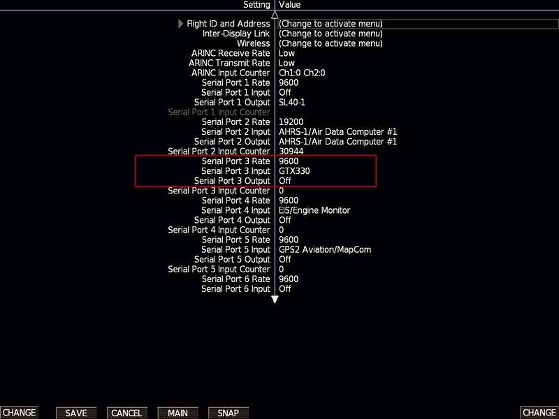
So...BACK to the house again, download it onto the thumb drive using our last remaining PC, drive back to the airport -- and success! This time the Horizon can see the .dat file, and it updates. The Horizon now shows that the TT-22 is talking to the GPS, and knows where it is in space. Success!
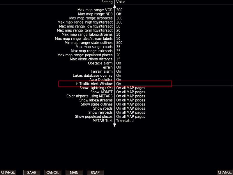
Here is what the set up screen looks like after the upgrade:

As you can see, it has a GPS position. Yippee skippy!
And here is the proof that ADS-B OUT is finally working! Garmin Pilot shows that we have FULL TIS-B (AKA: ADS-B out) working:

You wouldn't BELIEVE the amount of traffic we can see on the Nexus 7 now! So, all is well, right? WRONG!
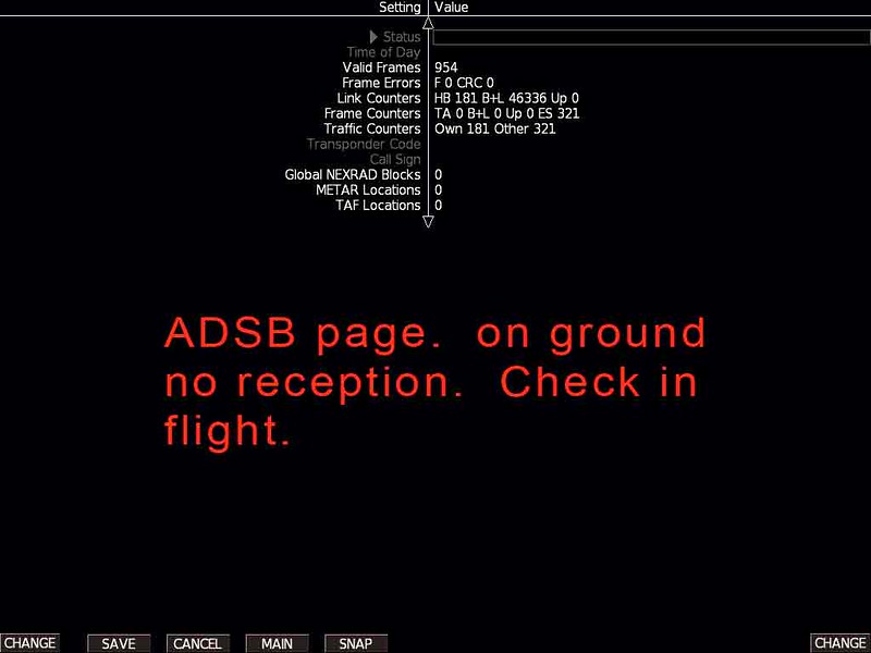
Incredibly, I now have NO traffic showing on the Horizon HXr screen at all. Here is a shot of the screen, showing absolutely zippo for traffic, while the Nexus 7 was showing a LOT of traffic:

Okay, now here is where things get really, really weird. Immediately after take-off, after doing the update, traffic showed up on the Horizon for a brief time -- perhaps less than a minute. I was ecstatic, then crushed, when it all disappeared.
After flying for 40 minutes, and finding no way to make traffic reappear, I gave up and headed back to the airport. As I was on downwind, about to turn base, suddenly the screen came ALIVE with traffic! There it all was, in all it's glory, with over a dozen targets overlaid beautifully on top of the sectional chart.
I let our a yippee (which startled Mary), and decided to depart the pattern to see what this was all about. As I built up speed and started to climb, *poof* -- the targets ALL disappeared. I reentered the pattern and landed, without seeing them again.
WTH is going on here? What could possibly cause this sort of behavior? I've got perfect ADS-B weather depiction, the screen is showing as many as NINE ADS-B ground stations in sight, yet no traffic is being painted on the screen?
Just FYI: We've got the dual-band Skyradar system attached (via USB) to the Horizon, for ADS-B in, with external antennas mounted on the belly of the plane.
Any and all advice is appreciated!
Today I spent several hours of quality time trying to my Trig TT-22 Mode S transponder (ADS-B OUT) configured properly, after I realized that I was seeing WAY too much traffic out the front window that was NOT appearing on my ADS-B screens. (I also have a Nexus 7 tablet, running Garmin Pilot, with ADS-B traffic and weather overlaid on that screen.) I realized I was receiving passive ADS-B "in", but obviously my "out" was not triggering the ground stations.
After phone calls to GRT, in which I spoke to Mark and Ben, and utilizing advice given by Katie here yesterday, I made some changes to the setup window that allowed the GRT GPS to "talk" to the TT-22. We also determined that I could install the TT-22 adaptor's recent software update through the USB port for the Horizon HXr. This was good news, indeed. (Previously, we thought we would have to send the unit in for an update.)
So, I ran back to the house, downloaded the TT-22 adaptor's update to a thumb drive, drove back to the airport, and...no joy. The Horizon could not "see" the .dat file on the thumbdrive.
So, I thought, perhaps it can't be placed in the root directory. Back to the house I go, download it again, this time into subdirectory on the thumb drive. Drive back to the airport...and no joy. The Horizon still could not see that .dat file.
So, I call GRT. Ben asks what computer I'm using to download the update file. I tell him a Chromebook. He tells me that he knows it works using PCs, but that Apple computers often do something to make the .dat file undetectable. He doesn't know what a Chromebook will do. Our only logical assumption is that the Chromebook is formating the thumbdrive in a way that makes the .dat file unreadable.
So...BACK to the house again, download it onto the thumb drive using our last remaining PC, drive back to the airport -- and success! This time the Horizon can see the .dat file, and it updates. The Horizon now shows that the TT-22 is talking to the GPS, and knows where it is in space. Success!
Here is what the set up screen looks like after the upgrade:
As you can see, it has a GPS position. Yippee skippy!
And here is the proof that ADS-B OUT is finally working! Garmin Pilot shows that we have FULL TIS-B (AKA: ADS-B out) working:
You wouldn't BELIEVE the amount of traffic we can see on the Nexus 7 now! So, all is well, right? WRONG!
Incredibly, I now have NO traffic showing on the Horizon HXr screen at all. Here is a shot of the screen, showing absolutely zippo for traffic, while the Nexus 7 was showing a LOT of traffic:
Okay, now here is where things get really, really weird. Immediately after take-off, after doing the update, traffic showed up on the Horizon for a brief time -- perhaps less than a minute. I was ecstatic, then crushed, when it all disappeared.
After flying for 40 minutes, and finding no way to make traffic reappear, I gave up and headed back to the airport. As I was on downwind, about to turn base, suddenly the screen came ALIVE with traffic! There it all was, in all it's glory, with over a dozen targets overlaid beautifully on top of the sectional chart.
I let our a yippee (which startled Mary), and decided to depart the pattern to see what this was all about. As I built up speed and started to climb, *poof* -- the targets ALL disappeared. I reentered the pattern and landed, without seeing them again.
WTH is going on here? What could possibly cause this sort of behavior? I've got perfect ADS-B weather depiction, the screen is showing as many as NINE ADS-B ground stations in sight, yet no traffic is being painted on the screen?
Just FYI: We've got the dual-band Skyradar system attached (via USB) to the Horizon, for ADS-B in, with external antennas mounted on the belly of the plane.
Any and all advice is appreciated!